
 Amazing and powerful spirit
from Lauca to Hornocal via San Pedro de Atacama
➥ North Area - Putre-Stage
Year: August 2018
Countries: Chile, Argentina
Km: 4708
Vehicle: Volkswagen Amarok 4x4
Camera: Sony A7
Directing: GPS with OpenStreetMap
Planning & arranging: Self
Driving: Self-drive
in bold location to stay
PUTRE-STAGE:
- Calama
- -> Iquique ?
- -> Putre ?
- Parque Nacional Lauca (Cotacotani, Chungarà) ?
- Volcan Taapaca, Quebrada Allane, Quebrada Colpita & Suriplaza ?
- Volcan Guallatiri & Monumento Natural Salar de Surire ?
- Parinacota & other pueblos (the info about such Andean Publeos are spread around the 3 day-trips above)
...proceed on the journey: let's go to San Pedro de Atacama!
SAN PEDRO-STAGE:
- ->San Pedro de Atacama
- Valle de la Luna
- Valle de Marte
- Quebrada de Talabre, Volcan Lascar & Socaire
- Aguas Caliente & Laguna de Talar
- Vado Putana & Machuca
- Reserva Nacional los Flamengos (Laguna Negra, Monjes de la Pacana, Salar de Tara)
TILCARA-STAGE:
- -> Paso de Jama (border-post Chile/Argentina)
- Salar de Loyoques
- Cuesta de Lipán, Salinas Grande, Purmamarca
- -> Tilcara
- Quebrada de Humahuaca & Hornocal
see here info about Atacama, what not to miss & tips in a trip to Atacama

Calama is a dusty ugly town, home of the World largest open pit mine and the hellish story this place tells: Chuquicamata, La Tumba del Chileno, as Marcial Figueroa wrote.
This place has been the one where thousands of miners and child-miners died and have been buried, where human rights, respect and dignity did not exist.
This is the place Indios lived in the hell, but also the place where one of the most romantic and adventurous journey in history started.
Chuquicamata inspired a young Ernesto Guevara who visited the mine on 13th March 1952 and saw with his own eyes the horror of such a place, where miners forgotten also by God were dying to get the daily bread.
Here, Ernesto Guevara, before turning into the World most celebrated revolutionary "Che", understood his vocation to travel forever around the World, to see and to learn the real World. This ugly, sad place is the place where a specific ideal of travel has been settled into contemporary culture. Reivindico absolutamente el derecho al vagabundeo, a la aventura, a la utopìa y al romanticismo.
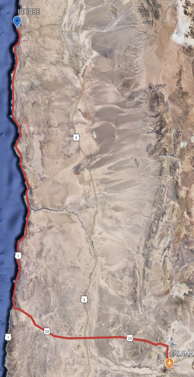
In a practical sense, Calama is the best landing airport to start your travel through Atacama, whatever you are flying from (flight from Santiago takes 2 hours approx).
Calama is well connected by paved roads, working as start of expressways perfectly located in the middle of Antofagasta, Tarapaca, Arica & Parinacota regions, which are the main and huge northern area of Chilean Atacama.
In Calama small but well served airport you will find the best car rental options of the region: thanks to the several mines businesses, they are very well equipped with excellent 4x4 vehicles, which you cannot miss out if you like to enjoy your trip without risk of being stuck or being prevented to go in the must visit places.
Last but not least, Calama is just 100km (1 hour drive approx) far from San Pedro de Atacama.
|
|
Iquique is a port city, strictly linked to mining industry. Peruvian identity and feeling are still quite visible as the city, as the entire region, become part of Chile just over the Pacific War in late 19th century.
As brief curiosities: the area of Iquique have been inhabited by Changos several thousands of years BC. The city has been a stop over for the Beagle of Charles Darwin in 1835. Iquique has been theater of the strenuous and most crucial navy battle of the Pacific War: "Battle of Iquique". In Iquique occurred one the worst massacre of contemporary history in Latin America, as Chilean army open fire killing thousand of miners and families who were claiming better living and working conditions.
Iquique is one of the driest city in the World, having entire years without rainfall and, unluckily, one the cities mostly affected by devastating earthquakes.

Iquique is a good stop-over on the way to the far north of Atacama. It's really a pleasure to enjoy the nice and extensive seafront, where a green and well maintained green strip divides the deep blue of Pacific Ocean and the vital and tingling city, which is imbed between the white bubbly huge ocean waves and sandy endless dunes and mountains.
In Iquique we have had one the best and most addictive Pisco Sour (Peruvian culture footprint) of ever. It was in a Peruvian restaurant along seafront, where we enjoyed tasty fresh fish in a really nice and vibrant atmosphere.
Along the seafront you can enjoy an impressive numbers of cormorants just lying over the palms, getting back to the shore after their daily fishing session. Beware of their drops :)
We had just two stopovers in Iquique (one day each), but tourism here offers further chances like seaside and sandboarding. We just think it's worthy actually to spend no longer than this and enjoy a nice evening and a regenerating morning walk (to recover from Pisco Sour!), as the Desert Altiplano has so many incredible places to offer.
Frankly speaking the area driving from Calama to Iquique and also after Iquique to the north is really nothing special (sometimes a bit sad, ugly and boring), but you can come across from unbelievable endless downhill roads, huge petroglyphs, historical sites like old mines and battle-sites.
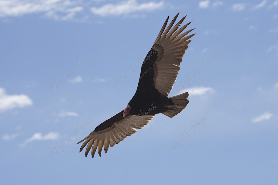 You will encounter a wide numbers of vultures and sea-birds colonies. Scenario will start to be more pleasant far after, when passing after Arica, you will get away from the coast (and from Arica as well!) and you will start to come across impressive green valleys filled of farming areas in the middle of endless gray sand and stones. Leaving this backwards you will start your ascent to the magic of Altiplano.
|
|
Putre sounds like to be San Pedro de Atacama far earlier than becoming a tourism superstar.
Putre is there, where's the magic commencing. Breathe and the Altiplano is inside you.
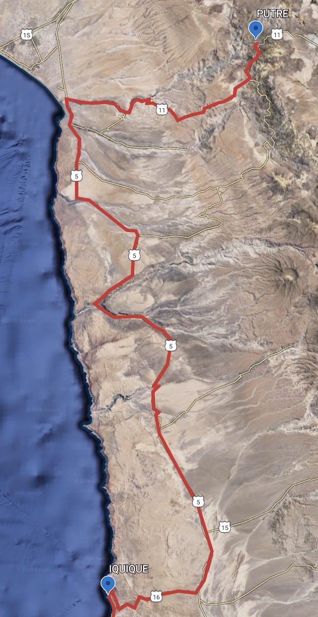
The Taapaca vigils as a threatening alcove over the village; this 5860 m asl volcano was a sanctuary mountain for Andean people (Aymara, Queucha, Inkas) and is nowadays, along the village of Putre, the gate for a World above and beyond. The Ruta 11 running just alongside Putre directed to Bolivia will bring you into the core of Parque Nacional Lauca and the A-23 will drive you in an even lonely and amazing land, but we will talk about these next.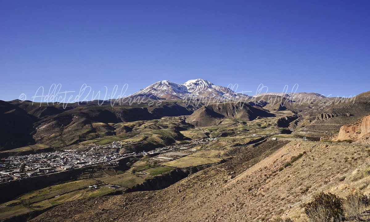
Putre is where you would like to be when you have experienced a bit the sense of the Atacama; this small town is still bringing you the genuine sprit of Altiplano, no frills, but sufficient tourist facilities to spend nice time in the town as basis to explore comfortably the northern area of Atacama.
We haven't found anything comparable to the vibrant nightlife you can find in San Pedro de Atacama, as Putre is more like a true mountain village far from modern tourism high-standards, but it offers you memorable memories far over whatever you can expect before landing there.
A small tavern where you come back every evening and become familiar, where every person has a story you could imagine and write a book about, local market used by the locals, dusty paths that immediately climb high mountains from the town center, snow, volcanoes, wind and the infinite that is a few kilometers just above you. Definitely, don't miss Putre.
Tip: consider Putre as check point to verify you are getting acclimatized, as road and trails climb up fast you will face the risk to fall into altitude sickness when visiting the Parque Lauca if you haven't given enough time to your body. You will find yourself eating coca candies like crazy, to resist!:)
Parque Nacional Lauca; Laguna Cotacotani & Chungará lake
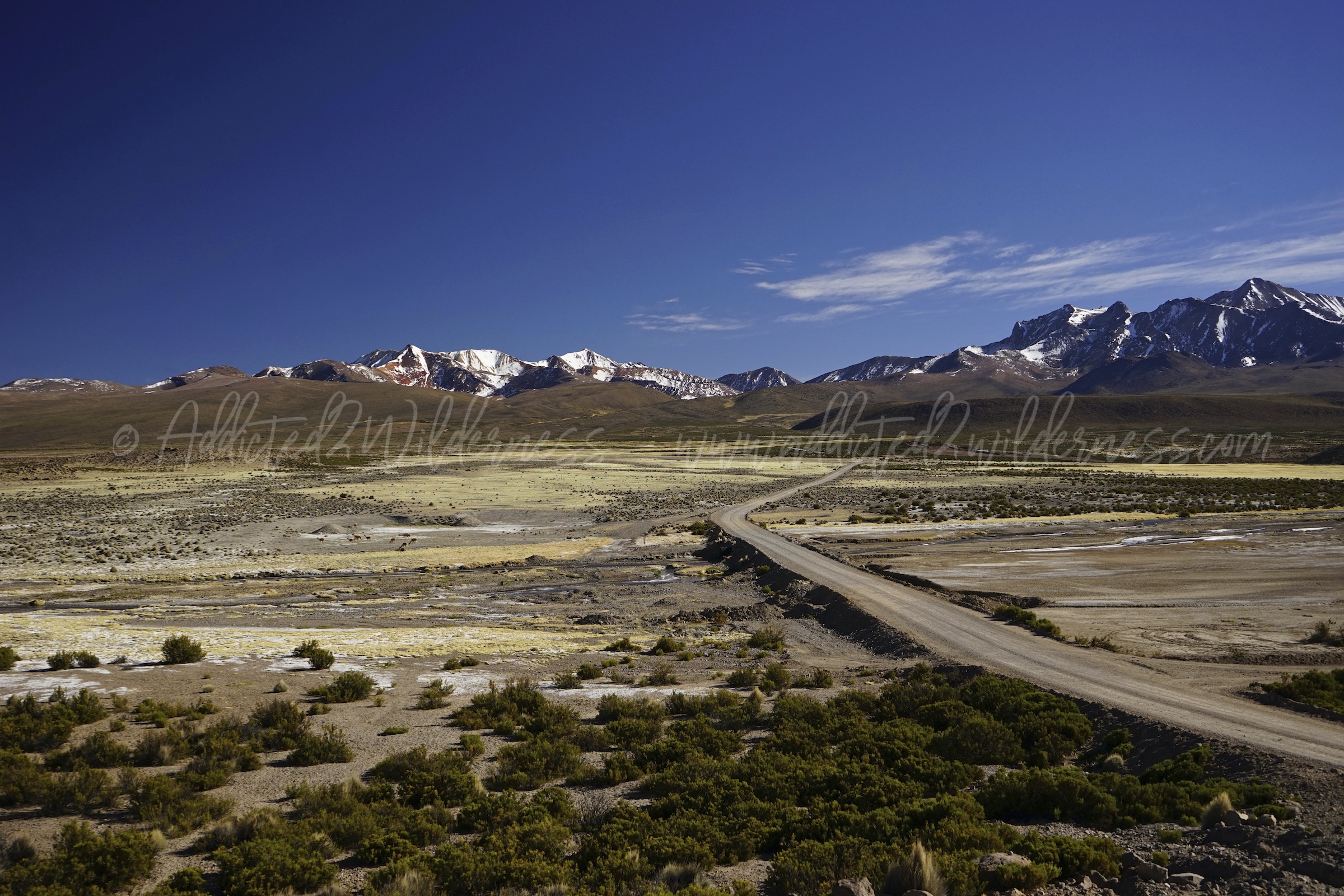
We left Putre early in the morning for a fantastic one day trip heading to Chungará lake. The Ruta 11 climbs up very steep and steady towards the wonderful plateu designed by volcanoes and Lauca river. Pay attention on the Ruta 11, as it is the main expressway to Bolivia it could be quite crowded as trucks must proceed very slowly due to the slope of the road. Approx half way between Putre and the pueblo of Parinacota, we had a stop over at Las Cuevas. It is a wetland created by the Lauca river flowing through the salt flat ground with a mix of hot/warm waters. We had a nice short trek through vicunas and a big number of vizcachas which will be there to entertain you along with a wonderful landscape.
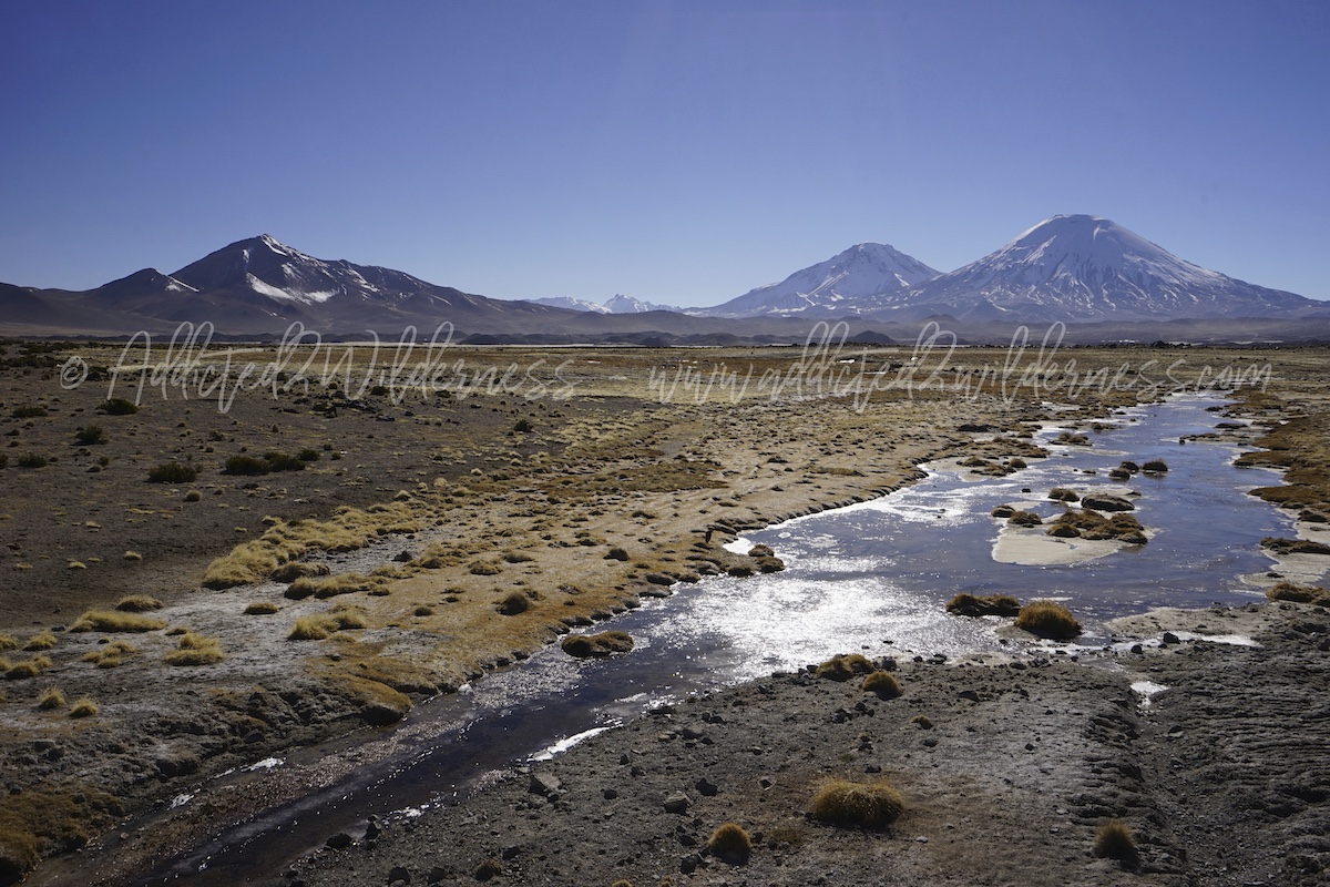
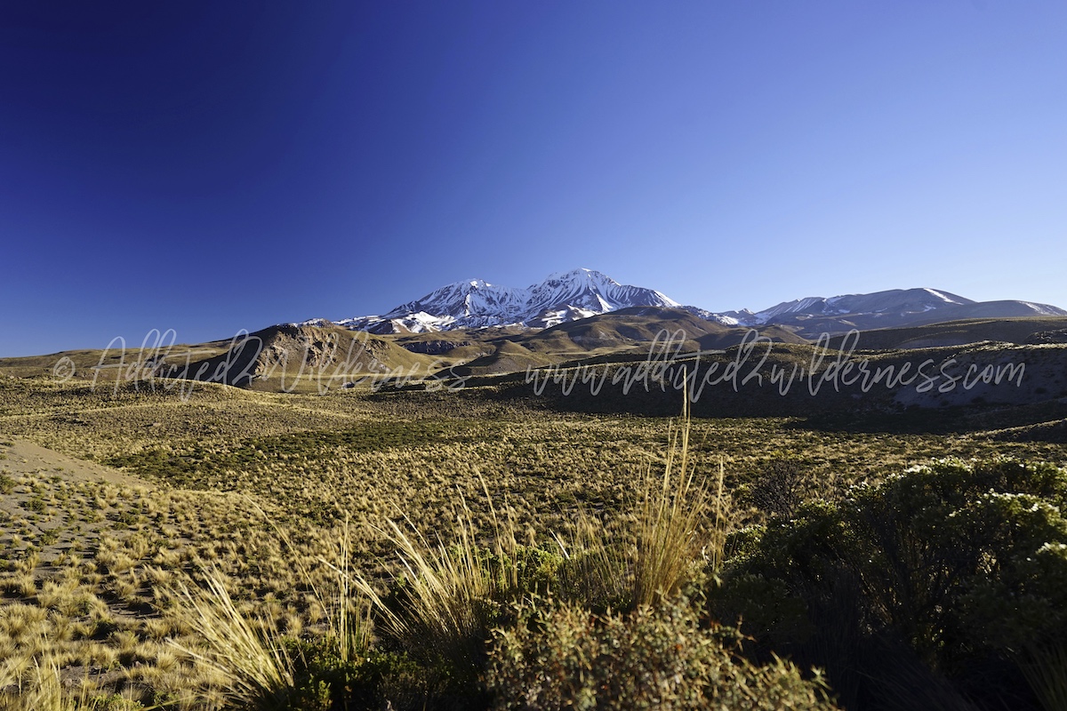
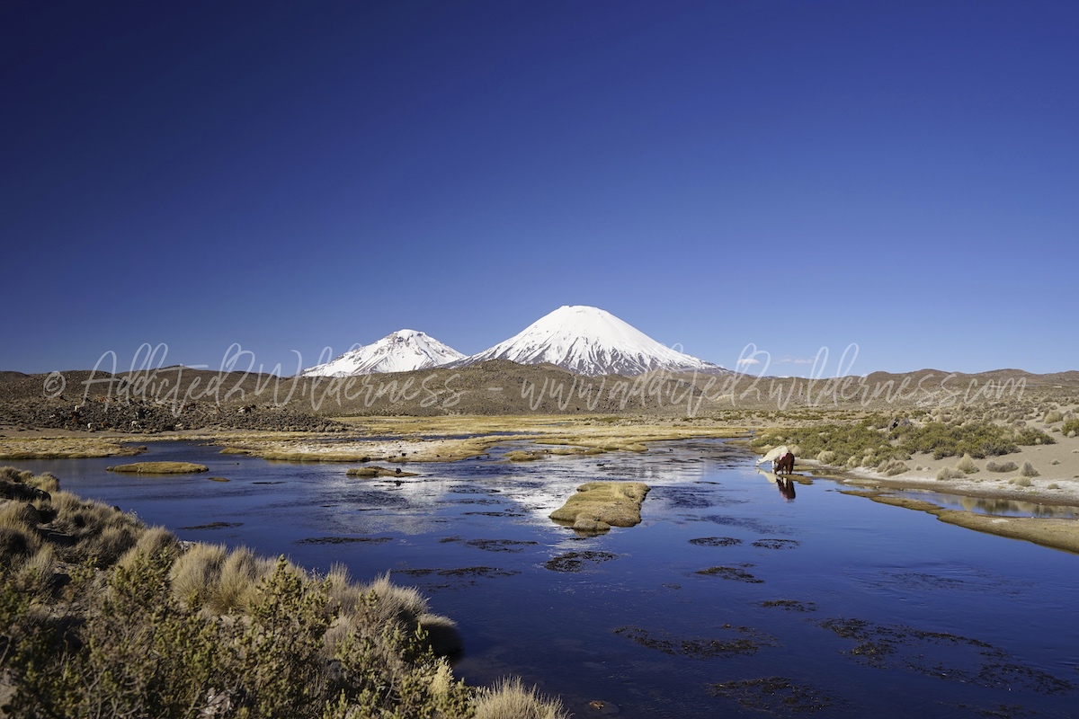
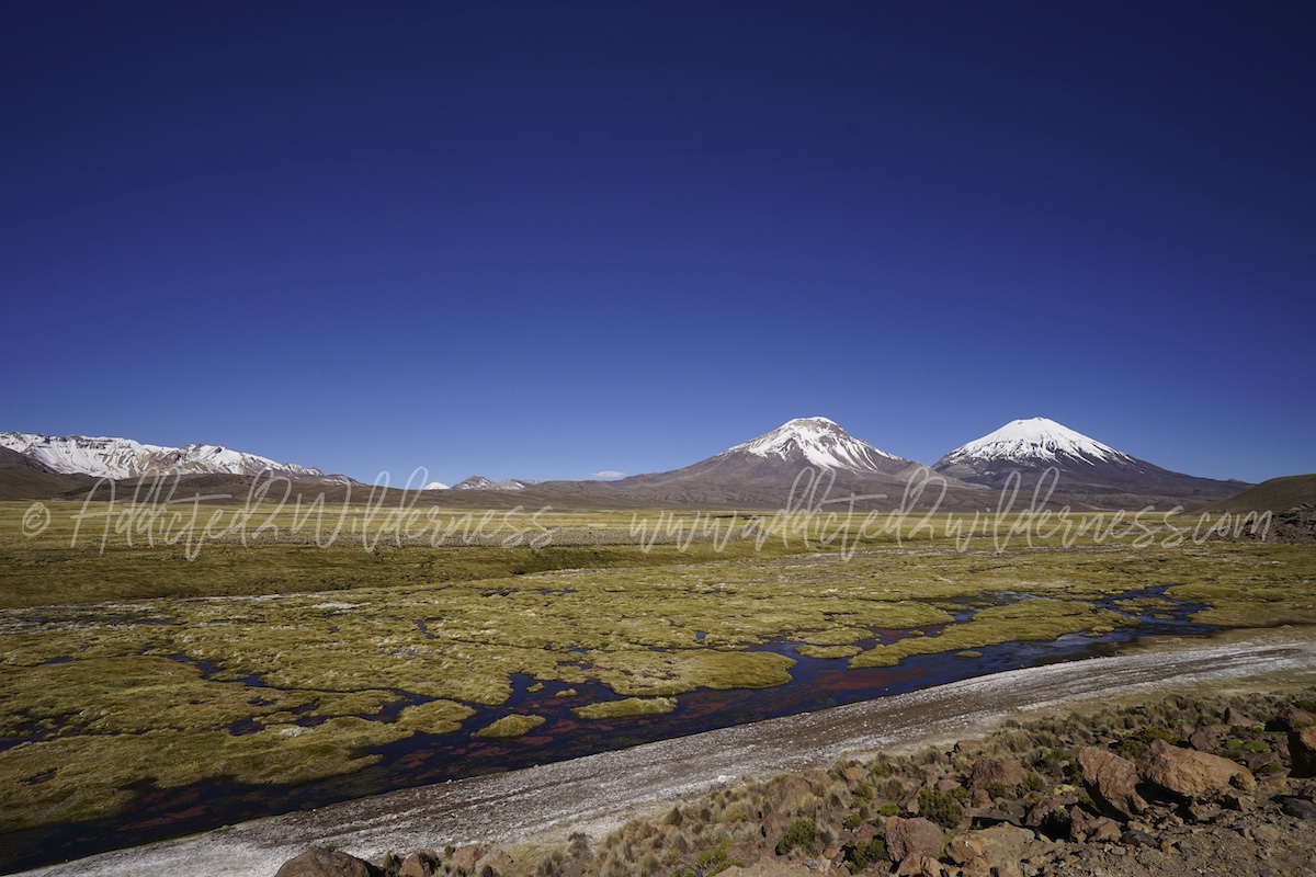
Proceeding on the Ruta 11 we landed on a endless plateu bordered by Laram Q'awa and Taapaca volcanoes on the west / north-west and the snowed cones of Parinacota and Pomerape volcanoes on the east / north-east. Such skyline and everything filling this wonderful flat valley brings you within a fairy story.
Alpacas approaching you curiously and running vicunas roaming into wetlands, rocky desert and water flowing massively through grasslands are an unmissable scenario (there is a good spot to take some nice photos just around the area where the Ruta 11 cross the Lauca River, approx around Chucuyo, looking to 180° / 270° west - north - east - see Viewpoint Lauca plateau and Parinacota Volcano signed on map above).
 Here above the view of the Taapaca you enjoy climbing up the Ruta 11 heading to Chungará.
Here below the view on Cotacotani lagoon along the Ruta 11
(see Mirador Cotacotani signed on map above)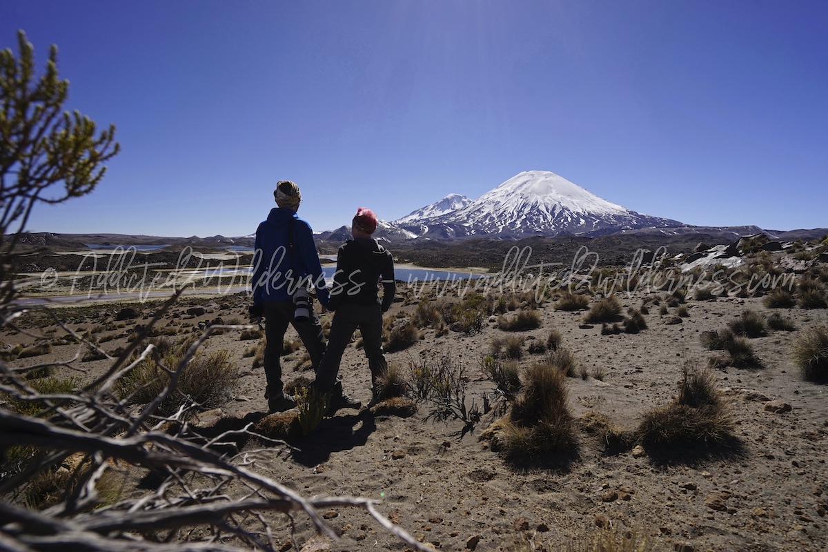
After funny greetings with the curious alpacas and several photos we keep on driving excited to discover the view on the Cotacotani. This amazing loogon is made up by an indefinite amount of lakes of various sizes depending on the trend of the snow-season. Stop at the mirador (see map above) by parking your 4x4 safely out of the roadway of the Ruta 11. At time of our visit the mirador was not marked on Ruta 11, so pay attention to catch it. Walk down (slowly as the altitude sickness may start) towards the lagoon and enjoy the astonishing view of Parinacota Volcano over the endless blue lakes.
From the mirador we crossed one of the hiking trails deployed around the lagoon up to the Pueblo of Parinacota and had a wonderful short trekking there with very nice spot points for our photos. Unfortunately the time in a such amazing day trip was quite tight and not enough for a serious trekking up to the village of Parinacota (almost full day hike), but just a short walk. It will be for the next time, as this place is wonderful. Note, as mentioned in this website the GPS with a good map is necessary, as hiking trails and good point of interested are not well marked or not marked at all.
We jump back into our 4x4 (we started to feel a bit the altitude sickness, as just the day before we were at the ocean side) and heading to Chungará lake. In the meanwhile the Ruta 11 brings you upper and upper, we are thrilled as the feeling is that you are going to top end of World. Actually it really seems in such way.
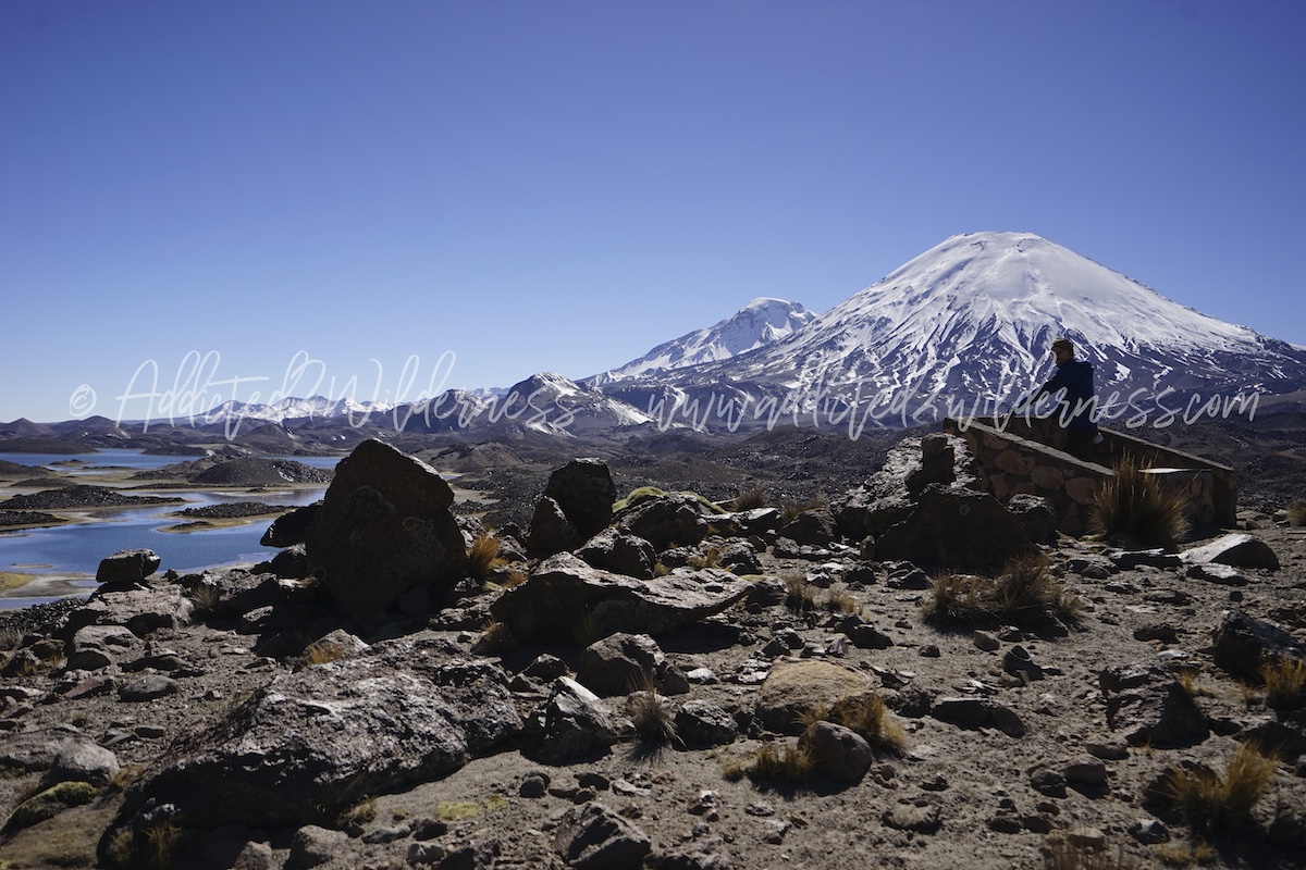
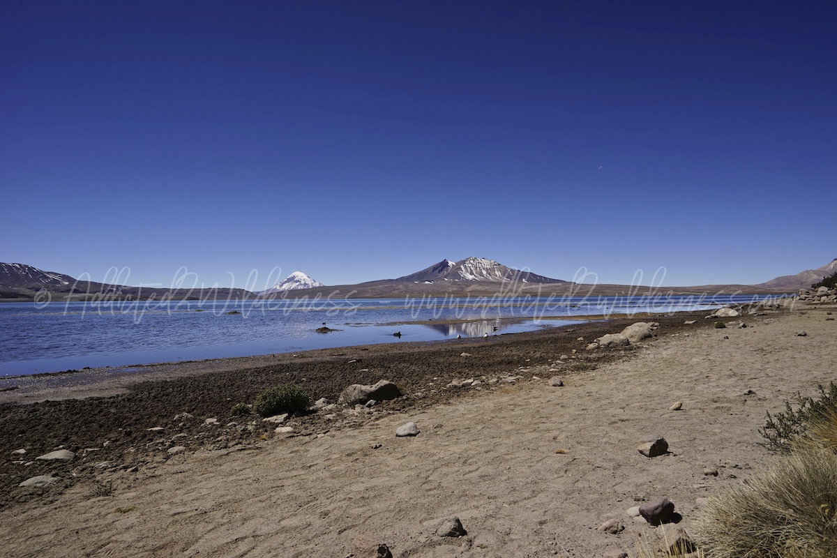
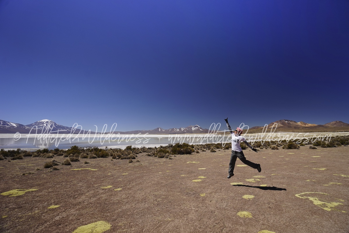
The road takes a while and then, there in front of you, we have the charm of the (probably) highest-altitude lake in the World (4570 m asl). Chungará is big, bigger than what you can expect for a such high-altitude volcanic lake. It has been generated by Parinacota Volcano collapse turning into a natural dam on Lauca River. Part of the water of Chungará flows into Cotacotani to feed the lagoon. The lake is now one of the star of Parque Nacional Lauca and finally Chilean Government protects its waters from human exploitation, after a big and long controversy luckily with happy ending. Major issue at the moment, as almost everywhere in the World, is the human waste throw by trucks in transit.
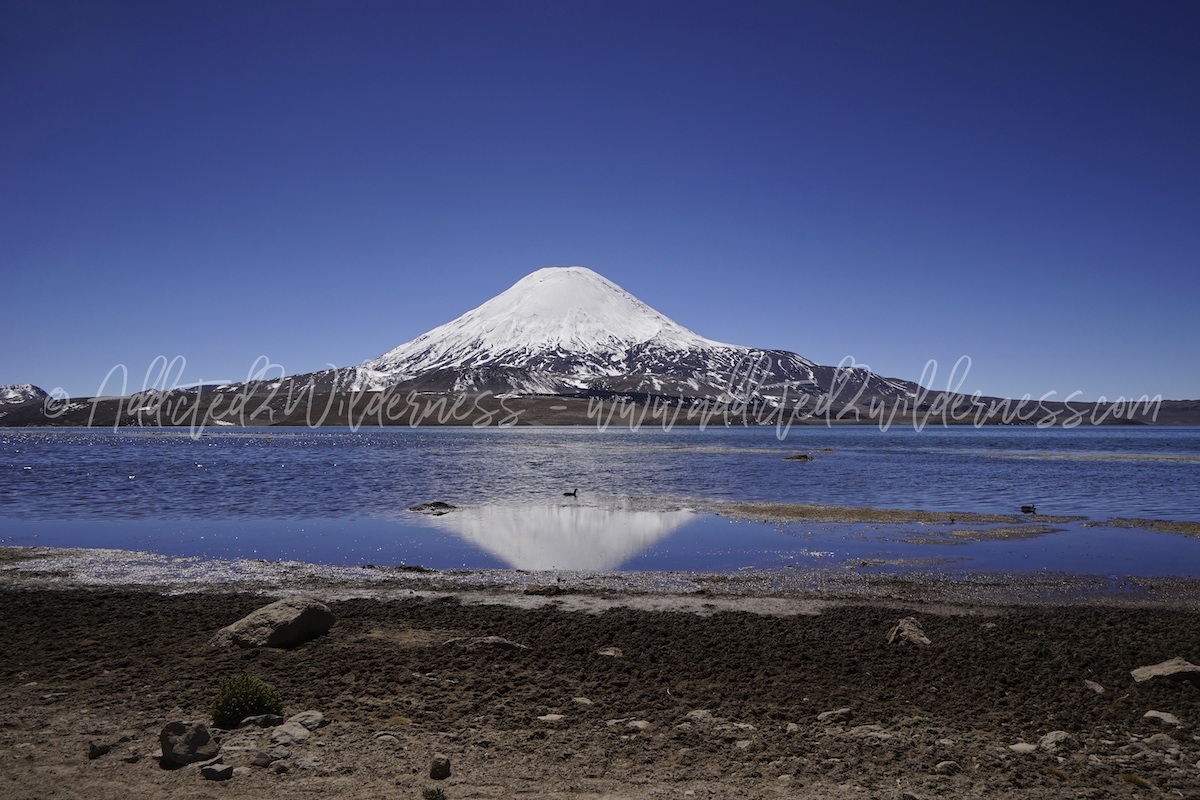
This place is far from narratable, as the volcanic frame soaring around the deep-blue water generate wonderful reflections, in which the super-star is the perfect and immense cone of Parinacota capped of snow.
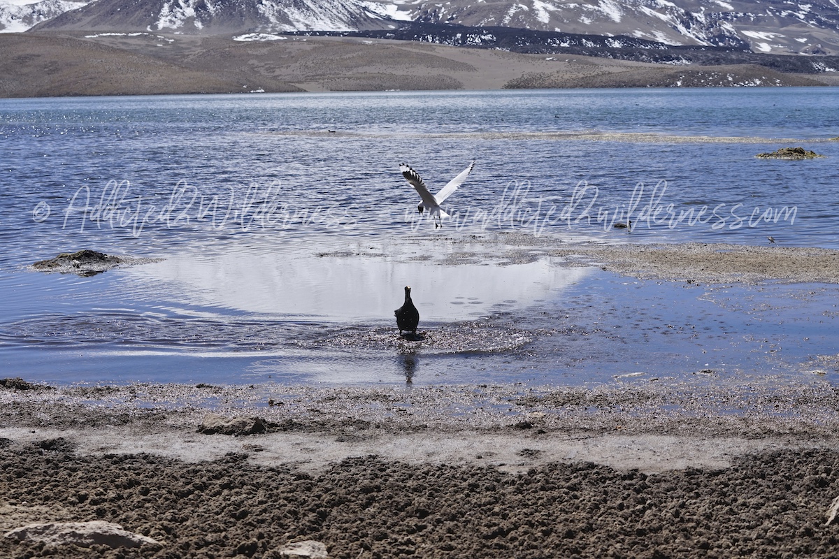
We parked at the CONAF parking area and started an easy flat hike trail along the south shore.
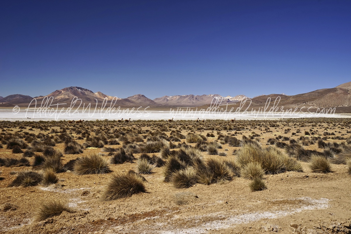
The trail in walking terms is quite short, but you will such a long time to shot photos to the landscape and to the huge numbers of birds populating the lake. Andean gulls, giant coots, puna plovers and many others will gift you unforgettable moments. Unluckily we missed flamingos here (but we did it at Surire two day after!).
Back to CONCAF parking we found that the puna (altitude sickness) starts to bite our heads (as said this was our first day up here coming from the ocean side), but everything around us was so wonderful that we jump into our 4x4 and set course for Parinacota Pueblo -see photo here below-
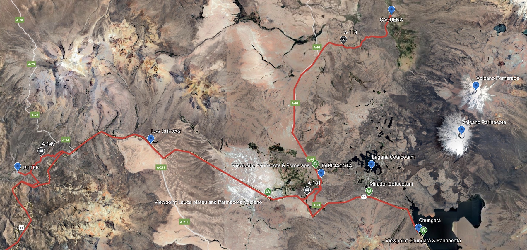
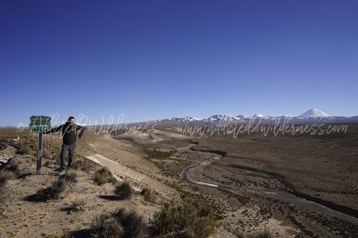
We drive back along the Ruta 11 up to the A-93 on our right. Just after few kms on this partially gravel road, the legendary pueblo is there. The landscape you can enjoy traveling on the A-93 is outstanding. - see photo here below - The gravel road is much more appropriate for these places than paved roads and you can taste the ultime sense of traveling into the wild. The same nice feeling is about the A-119 to Caquena (despite paved) and the detour on A-181 as connection back to Ruta 11 (see map above).
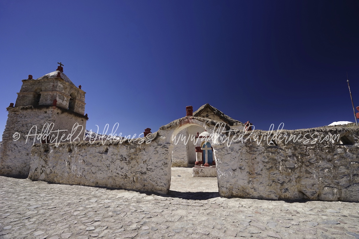
As pueblos in our day-trip, we stopped for a walk a some photos at Parinacota village, very nice spot, and Caquena, very nice landscape and extremely lonely place. The road to Caquena goes up and up and after such intense first full day on the Altiplano we were seriously tested by the altitude thickness, therefore Caquena has been our farthermost point for the day. Caquena is actually quite far from the main route of the trip, but is worthy as you will enjoy immense pristine area giving you unique very close view on magnificence of Payachata mountain chain (Parinacota and Pomerape volcanoes). - see photo here below -
Getting back to Putre, we take the detour road A-149. It is definitely slower and narrower than Ruta-11, but straighter to Putre and without heavy trucks on the road. The main thing that makes the A-149 absolutely worthy is the landscape, the nice view and feeling you can enjoy while driving on it and the much larger chances you have to spot some kind of wildlife we haven't encountered in other places in this area. Very nice.
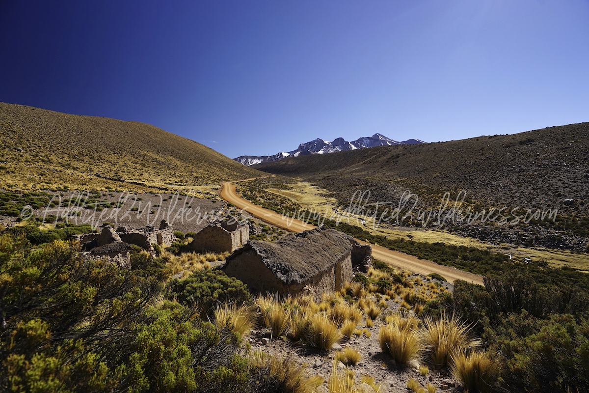
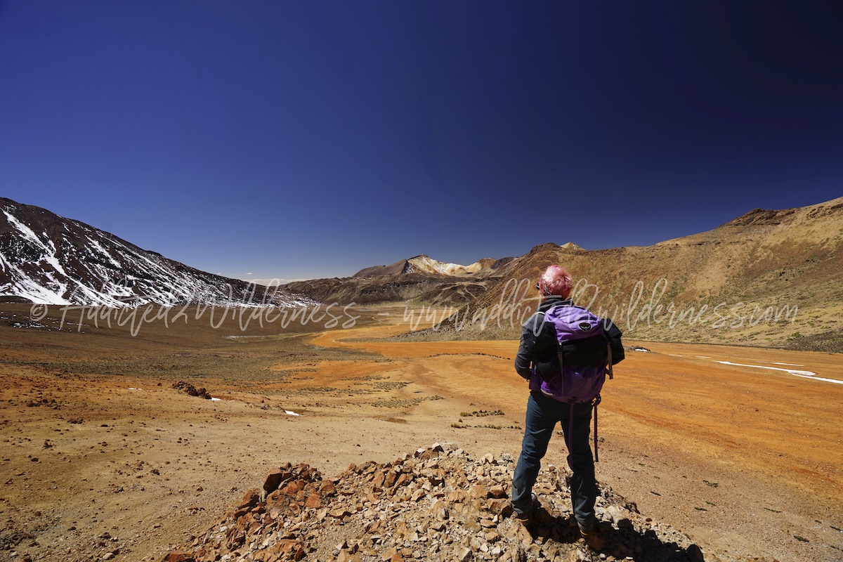
The day after (our 2nd day into the Altiplano) we embarked for a trip truly in the loneliness of such mystique land. Suriplaza was at top of our expectations and actually it goes even far beyond. It is great place Suriplaza itself, but a top class adventure-trip considering the way to get there. The drive brings you up to the Volcan Taapaca, down to various quebradas lying back the north face of the volcano, then riding along the infinite semi-flat areas where there are only few semi-desert pueblos. As last step up and up to Suriplaza. All this is increbidle: beauty, freedom, wilderness, loneliness, respect and reverence for such immense and powerful nature pervade you in a such silent loudness.
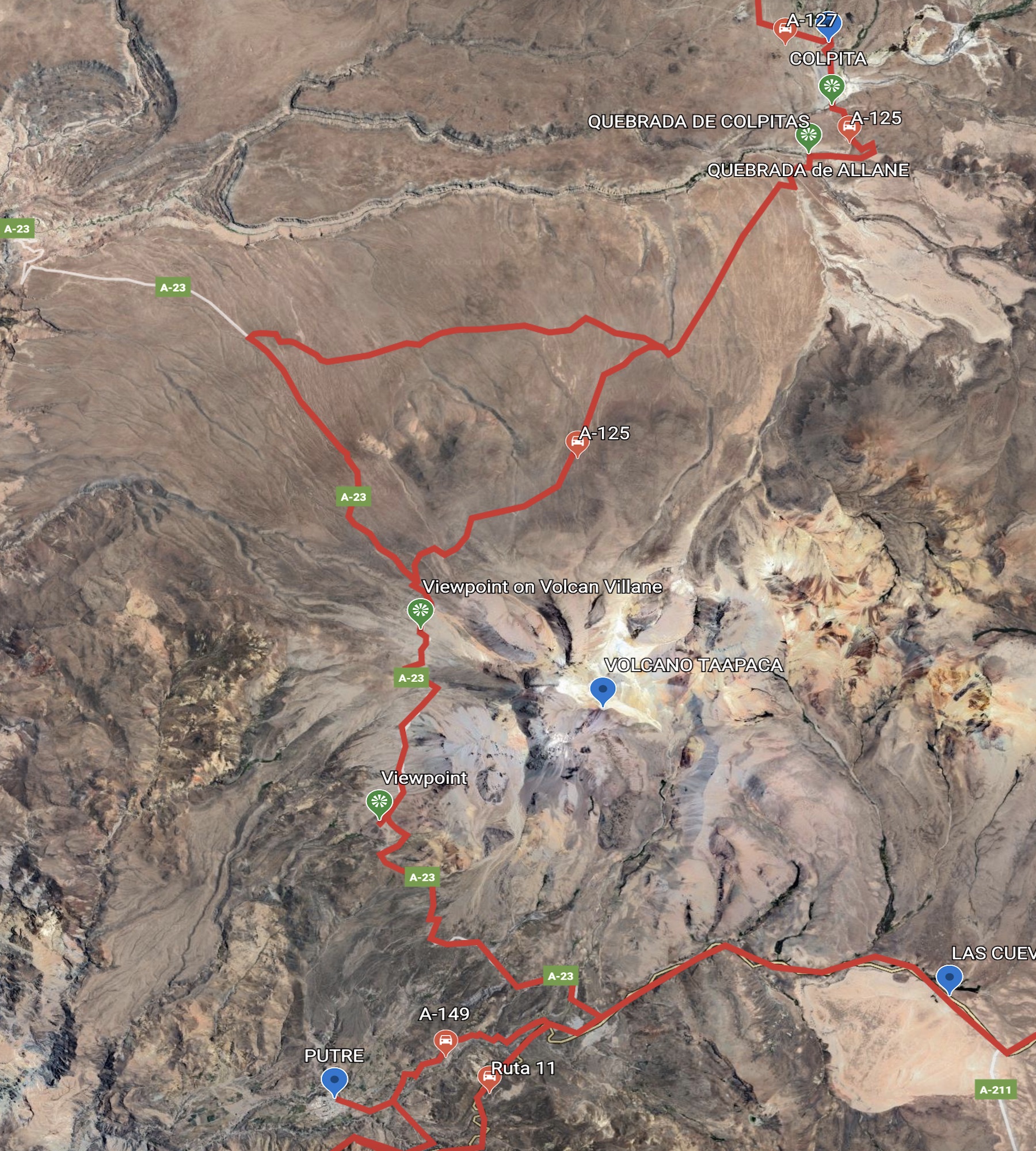
Here below maps about the route from Putre to Suriplaza. First one is section of climbing up Taapaca and down to Colpita, second one is section of climbing up from Colpita to Suriplaza. Pay attention to record on your GPS maps the waypoints. It will help you to get to Suriplaza easily.

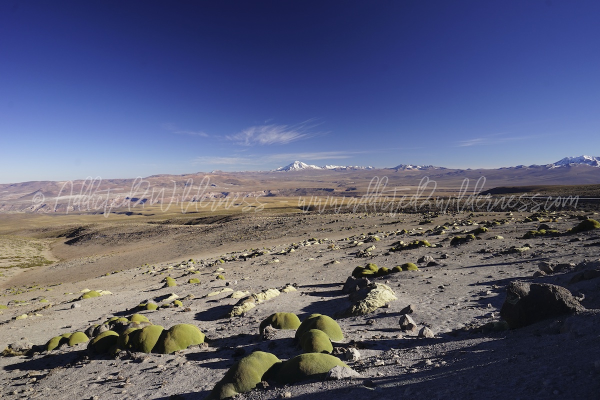
Wake up early in the morning, breakfast and amazing complete 4x4 refueling at our lodge (no service station in Putre) directly by cans. After picking up some food and plenty of water, we make sure to have all our gears (various layers of trekking garments, tools, maps, gps and cameras full of batteries), we start our drive along the pleasant A-149 with Taapaca just above us. After a short on the Ruta 11, we take the A-23, climbing up so steady along the slopes of Taapaca volcano. The drive up on the A-23 is exciting and so much adventurous, as you have the feeling to drive to the top of the World. From here, don't miss the endless view till the Volcan Villane. - see photo here below -
We started to come across the fairy yareta (Azorella compacta): this incredible flowering plant is now protected, as endangered by exploitation by humans due to its excellent combustible properties (in an area where almost no trees are present!). Yaretas are indigenous of the Andean Altiplano and live usually between 3500 m up to 5200 m asl. They can live for longer than 3000 years. Suriplaza sandy colorful basin seems to be yaretas' most proper and natural home. Please pay as much respect of such incredible living being: not to drive or not to walk over them. Just enjoy caressing and embracing them!
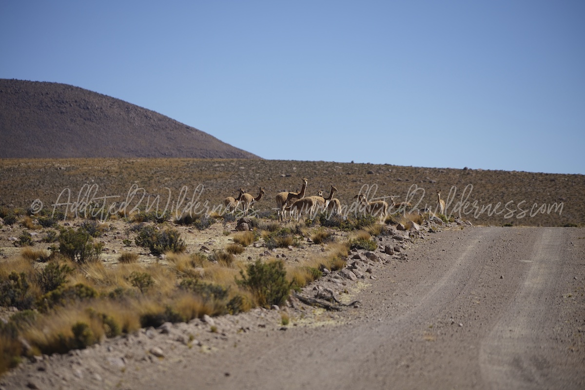
Once we get over the huge hump of A-23 along Taapaca western face and turn into the slope down towards Quebrada de Allane, we started to enter into an endless landscape, towering over infinite flats and quebradas. We take the A-125 on our right and we find that the north face of Taapaca is even more wonderful an "more Andean" style. On this side during our way back in the afternoon (we took an alternative detour - see map above) we encountered an multiples number of vicuñas herds. - see photo here below -
Moved on the ford of Quebrada de Allane, actually we the A-125 brings you driving into it for a while, we head to Colpita.
Passing the hump of the hills by some nice drive gravel road bends, what we find in front of us is Quebrada de Colpitas: this is one the most beautiful and majestic scenario we have ever admired in all our trips. No word can express this better than a picture -see photo here below-
Passed through the lonely village of Colpita we drive to cross the A-127 and then after few kms turn right into the "cruce A-127 / A-93" heading Cosapilla. Don't base your trip on road indications at all, you won't find anything comparable to western standard expectation and most of the times you won't find any at all. Please record the waypoints on your GPS map before embarking for the trip!
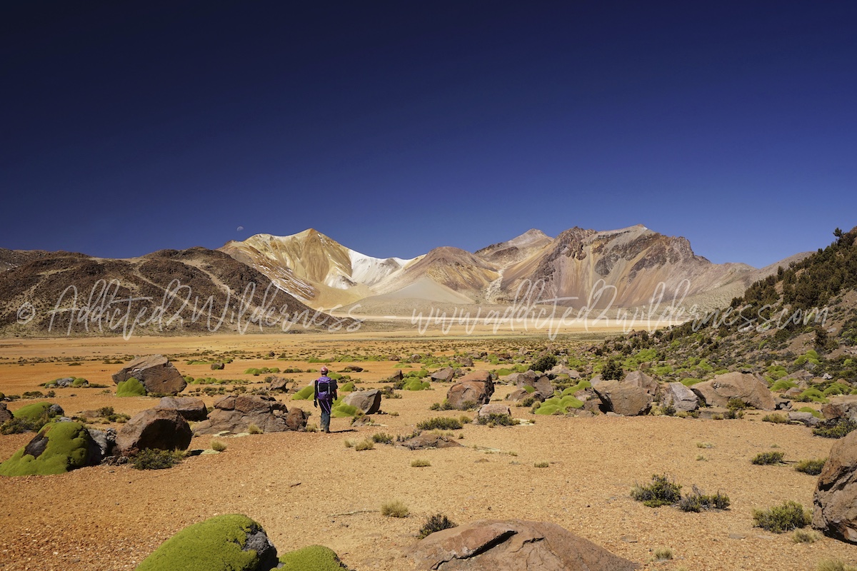
This amazing gravel road starts to climb up quickly heading to Suriplaza. Don't miss to stop along the way at some nice spot to take wonderful photos in whatever directions you can look. Nice viewpoint marked on the map above. - see photo here below -
Follow it until Suriplaza; last part before arriving is an nice succession of steep bends. You will find to be at Suriplaza, even before reading it on the sign announcing it, as after the bends you have the feeling to access into a giant castle or into dragoon's bowels.
We park our 4x4, look at the GPS map, record some useful waypoints, take all the necessary and let's go for a wonderful hiking within carpet of yaretas and herds of vicunas.
More or less you can hike everywhere you like, wherever your curiosity brings you, but always keep in mind:
-> full respect of environment
-> don't take risks as you are at very high altitude and in an extreme remote place and any accident or sickness could be fatal.
Before doing anything, please think over twice if you can easily face it and come out of eventual emergency situation by your own.
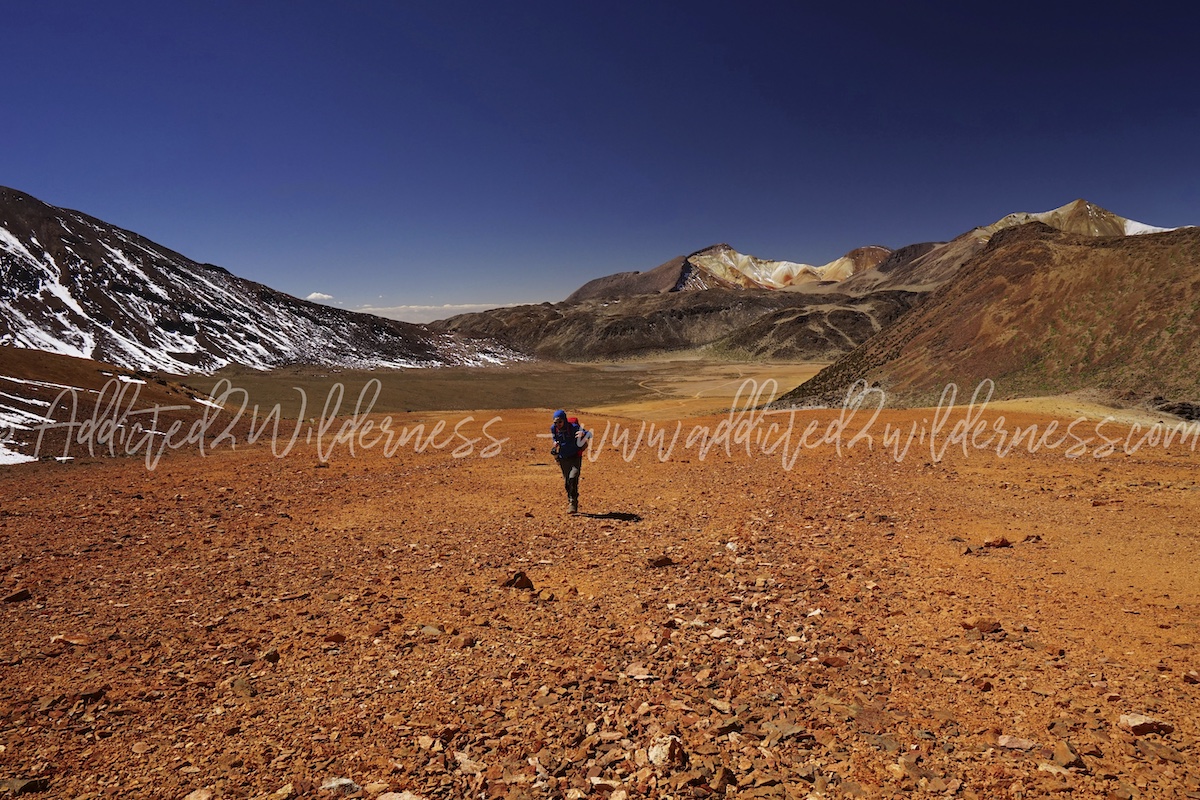
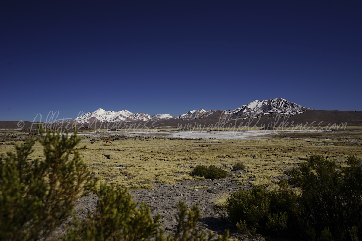
Hiking for a while gaining altitude gave us chance to admire infinite artist palettes painted over all the 4 peaks towering on Suriplaza.
Back to our 4x4, which we homespun refilled at our lodge prior to leave, we found very difficult to turn the engine on. Now we joke about it, but at that time it was quite concerning. To have been given wrong diesel fuel start buzzing in our head and being there in a such lonely place (may remain lonely for several days!) where temperature drops far below zero was a bit frustrating. Actually fuel was good, probably altitude just plays a role. Keep calm, think about how to solve in the most proper way and be proud to have prepared an emergency plan to deal with such kind of situation, even if you never need to put it in place. Learning from several tricky trips gives you the chance to joke about it one day! BTW, after a sequence of few trials our brand new Amarok started to roar! Let's go!
Going to Surire is such an incredible journey. Obviously a must is to wake up early in the morning, good, but light, breakfast, as usual geared-up with all the stuffs for such kind of adventure into the wilderness (fuel tank filled up, gps, maps, hiking equipments, plenty of water, food, cameras,...).
It is supposed to take approx 3 hours drive from Putre, mostly on gravel roads, but we had a bit longer in time, as having a good 4x4 you can enjoy in a relaxed comfortable way an amazing drive across so beautiful landscape. We find ourselves spending time to grab good photos, enjoying the wildlife crossing, admiring the sublime landscape and hiking on spot along various quebradas and in Guallatiri pueblo.
This is to say, drive is long and day is short, but definitely worthy. The journey to Salar the Surire is one of the main attractions to fix in the ultimate short list of a tour in Atacama.
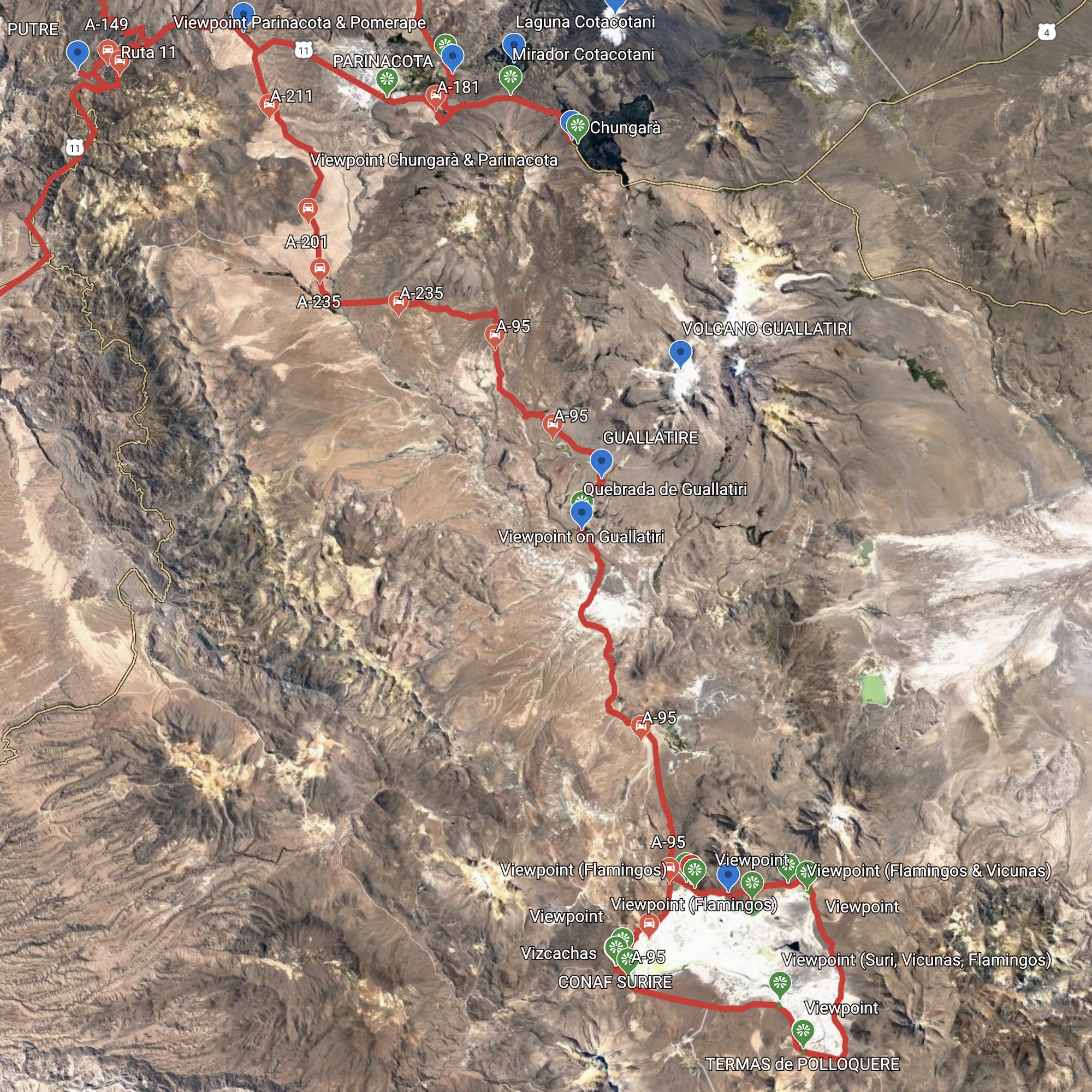
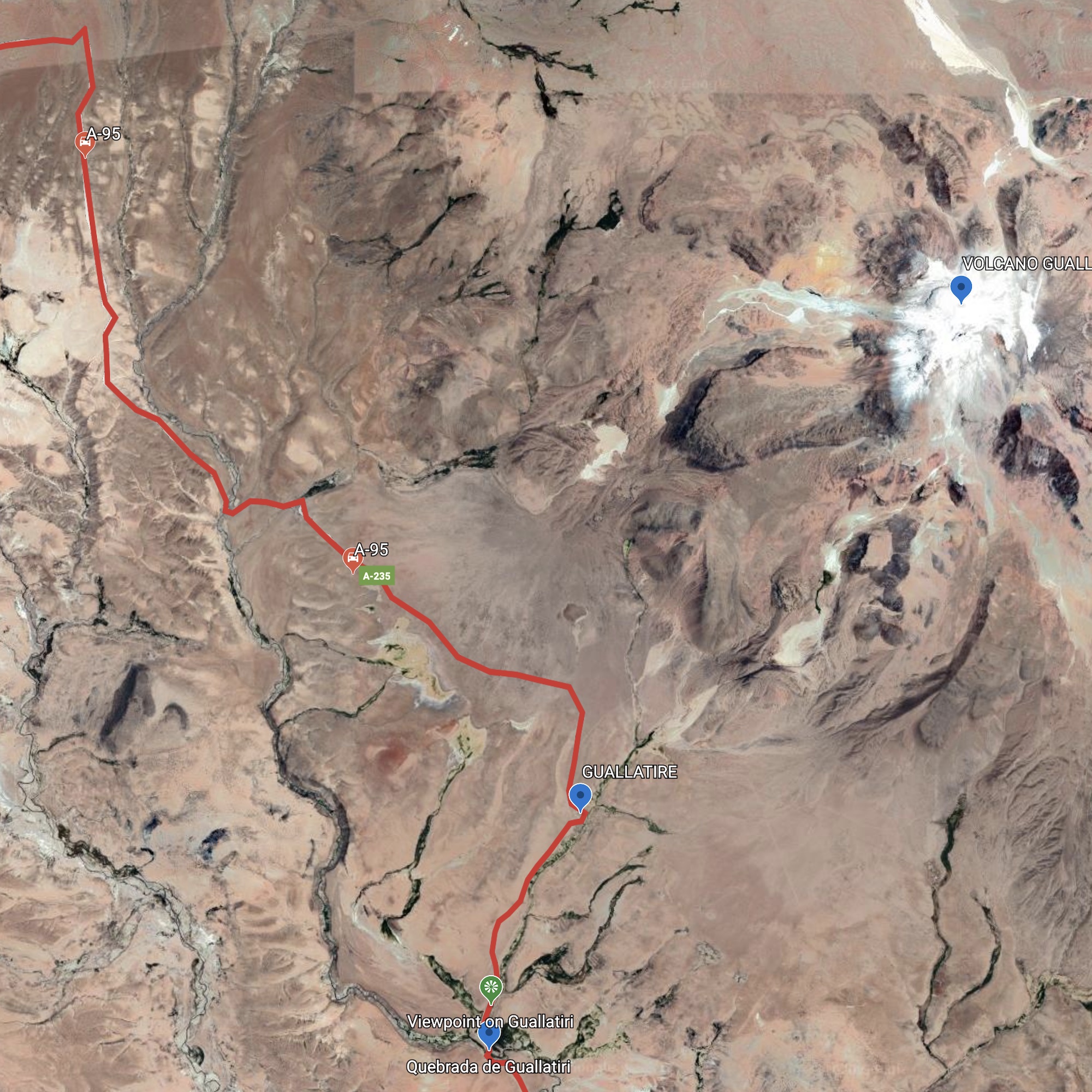
Here below the map about our trip from Putre to Surire. Further you will find a couple of others with details of Guallatiri area and zoom on Salar de Surire itself.
Briefly from Putre we take the Ruta 11 heading to west, few kms after Las Cuevas, we turned right into the A-211 heading south. Then A-235 (cruce Ruta 11 - cruce Ruta 95) to west up to the A-95. Pay attention A-95 is also marked on some maps as continuation of A-235.
A-95 is wonderful, the scenario driving alongside various quebradas having the smoking Guallatiri Volcano impending above you and Parinacota and Taapaca just on the other sight direction is astonishing. Wildlife is amazing too (on the way back an armadillo crossed our road!!!).
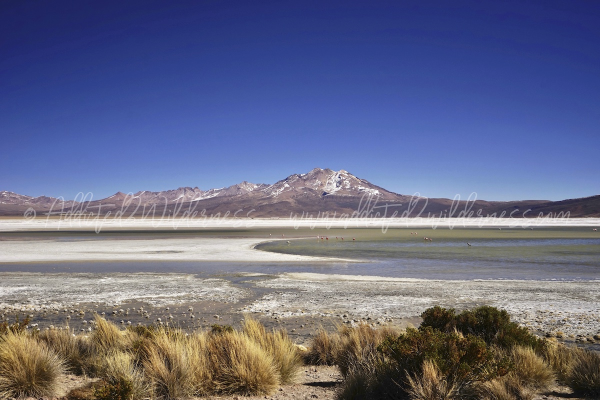
Leaving back the pueblo of Guallatire we keep on heading south, ford some rivers and relevant quebradas, we land at sight of Salar the Surire (see below further details). The name officially assigned is no doubt proper: Monumento Nacional Salar de Surire. For us may sound strange calling a natural place "monument". Actually is so much honest to recognize nature may be so great. Salar de Surire is actually a monument. A wild, lonely, living monument.
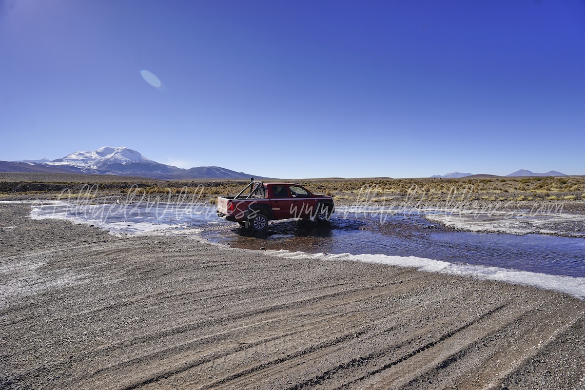
We had quite a few stops in our drive to Surire. The nicer section is commencing when we take the A-95: over the Rio Chusiavida the panoramas are fabulous and the adventure feeling driving on the gravel Ruta Andina (A-95) is at top.
Rio Chusiavida designs this section of the trip significantly as flowing alongside our road for quite long and we have to manage to ford it as well. Quite easily workable in August time (pay attention during different season), but very cool!
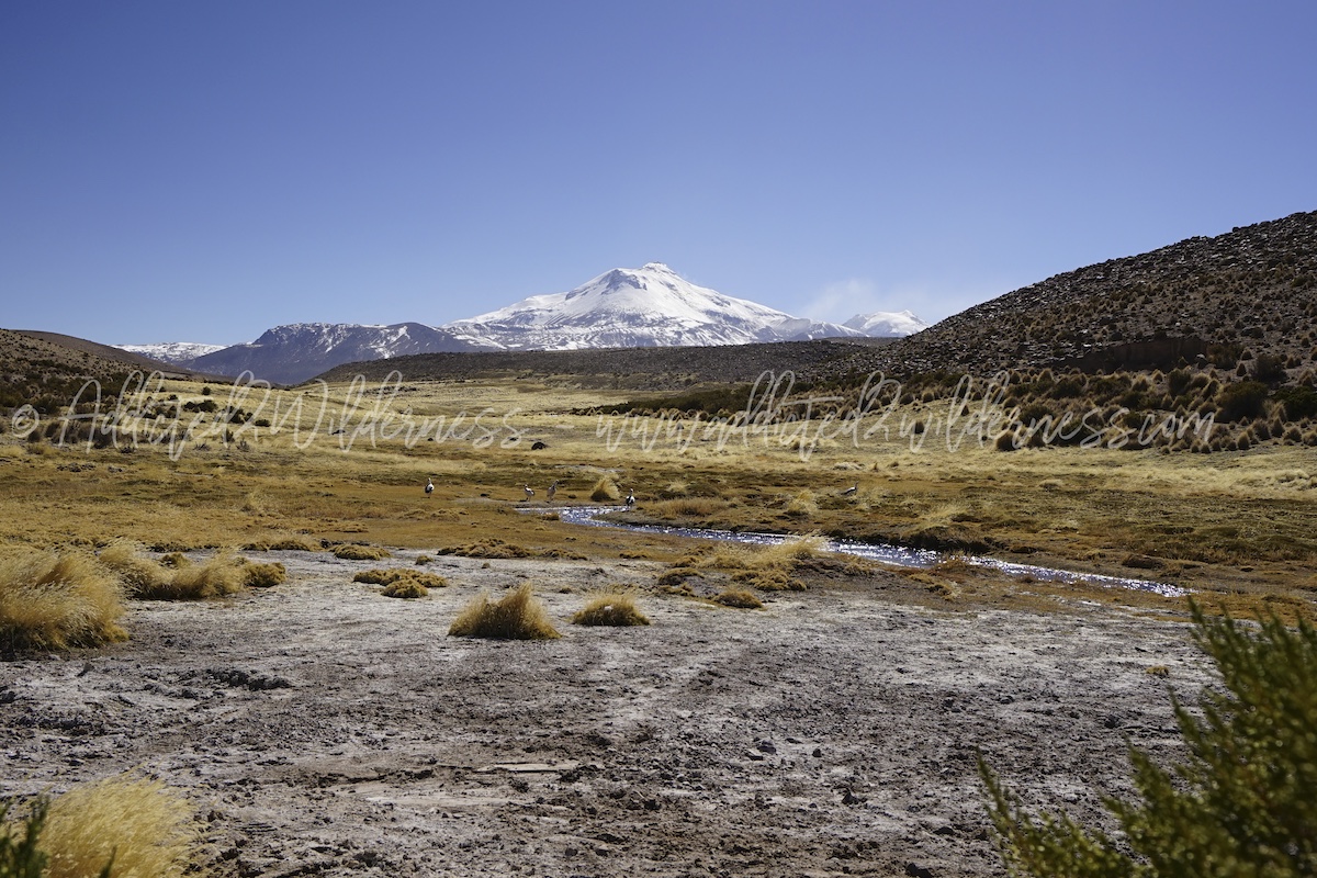
The river drains down into Rio Guallariti crossing it at the bottom of Quebrada de Guallatiri, which we found very worthy to spend a while for few nice photos.
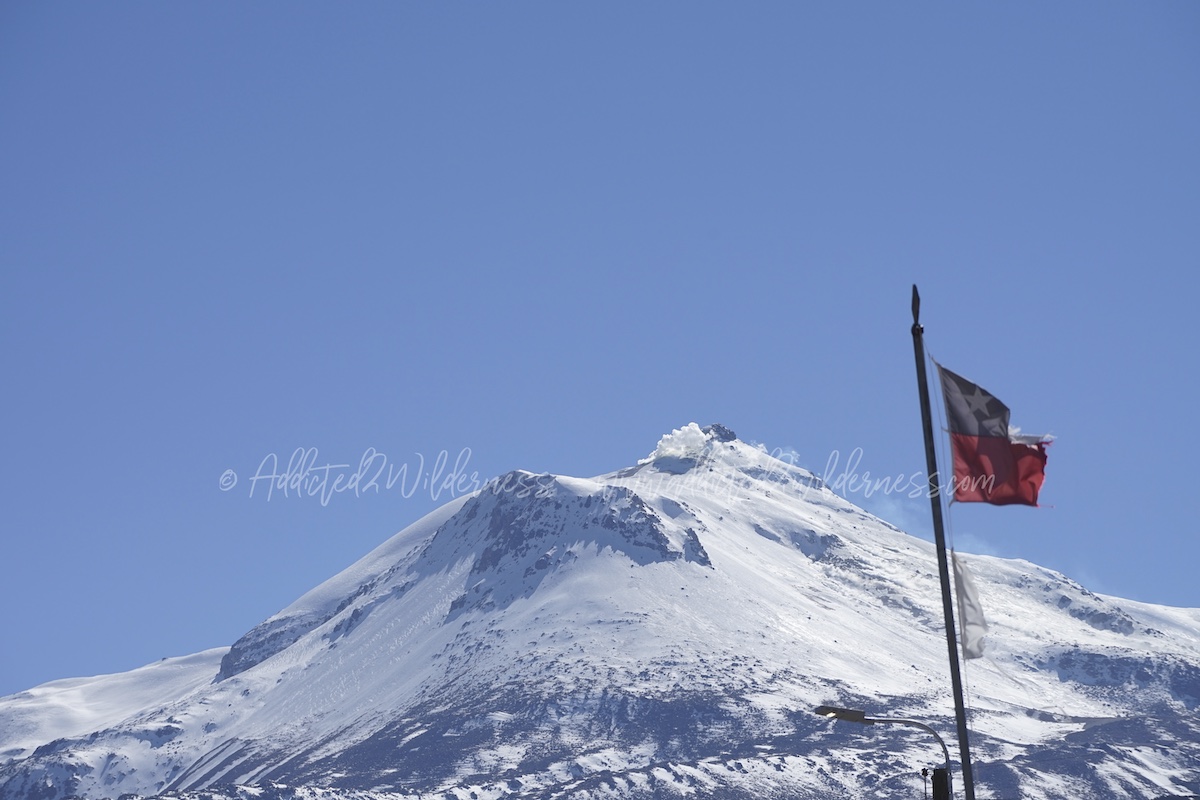
The Pueblo of Guallatire is lying just under the volcano's feet. Guallatiri is one of the highest active volcano in the World and is capped by a glacier (southernmost glacier in Central Andes) and we can admire quite closely the steam flow generated by this majestic peak.
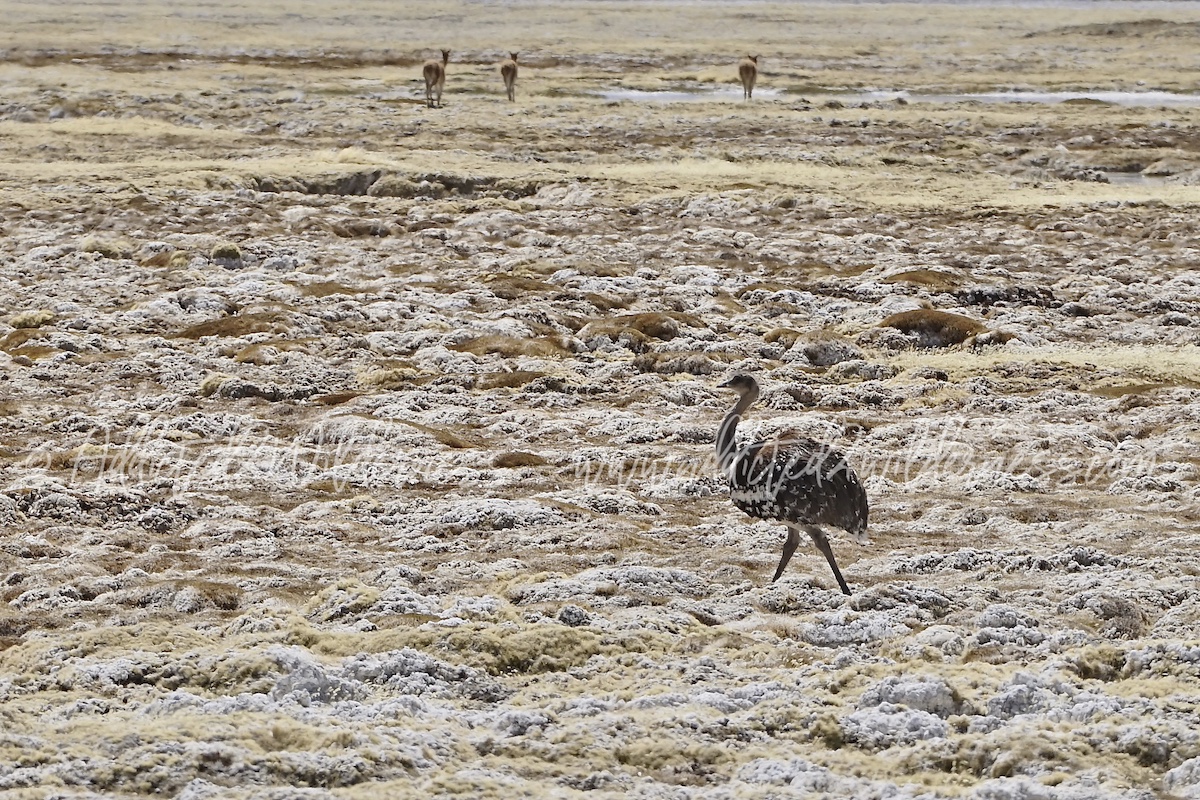
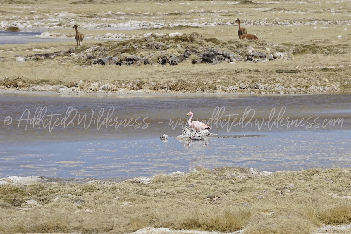
Guallatiri's name comes from Aymara, with the meaning of "place of wallata", which are the Andean geese. Actually we admired such incredible birds in the homonym Quebrada de Guallatiri just shortly past the Pueblo of Guallatiri. Luckily we came across a group of suri birds (nandù)!!! following you will find a photo of one suri we met at Surire.
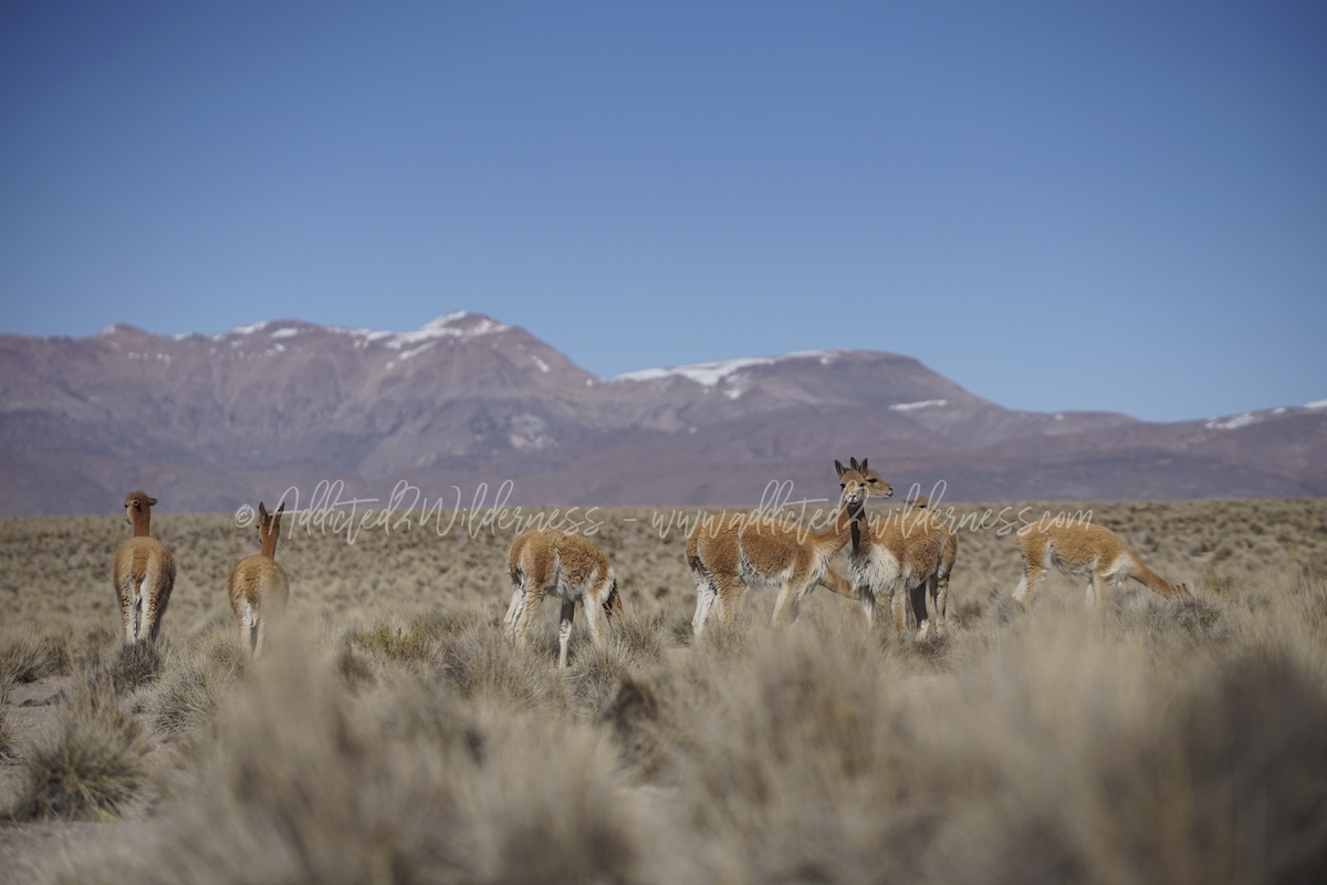
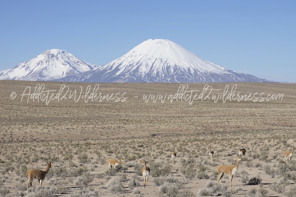
The area has quite abundant fauna, wildlife and breeding flock both. Vicunas and alpacas are always a pleasant meeting, which we enjoyed quite a few times along our drive on A-95.
Approx 1 hour further the A-95 slopes down to the Salar de Surire. We see just a little of human activity (trucks serving mines probably for lithium and boron) and we keep on driving straight ahead on the A-95 direction south. Actually, on our way back at the Carabineros' check-point they advised us we should have taken the left way when crossing the fork with A-235 and trailing the clockwise direction along the salar. Don't mind our counterclockwise track has been magnificent and don't worry no issue at all with Carabineros, who has been very friendly and welcome at our exit from the National Monument area. So, we drive on keeping the salar at our left heading towards CONAF's hut. - see map below - 
Looking east (our left in our drive direction) as the panorama is wonderful with volcanoes (Arintica is the main one) towering above endless alternation of salt pan and flats populated by vicunas we jump off many time from our vehicle to snap so many photos.
Conaf's hut is closed at time of our visit (haven't checked which part of the year is open), but the welcome there by viscachas family is so funny and we can enjoy it fully for us as the solely humans there around. Quick light lunch with a fantastic view on the salar landscape with continuous company of such curious and food-greedy friends. Ok, it's absolutely wrong to feed wild animals, we shouldn't have done it, but these viscachas are managing this hut as their own kiosk-business and run towards you begging for food like your home-pet making eyes.

Light lunch in a stunning loneliness, greetings to viscachas and let's go. We head to south staying close to the salar for a while, we take some further nice pictures, we meet some vicunas crossing our trail and in a short we are jumping off our vehicle once again for a short walk closer to one of Surire's fresh waters lake.
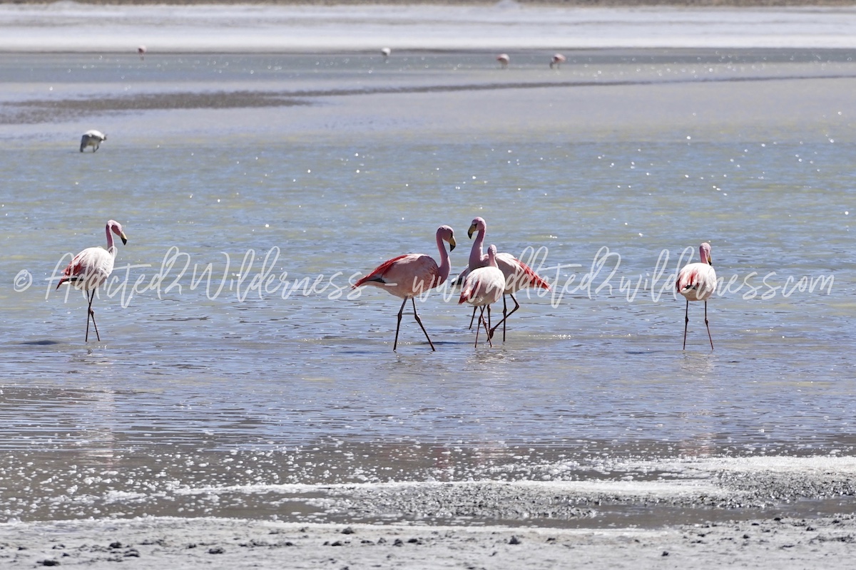
We proceed alongside the south shore of the salar, with waypoint fixed at the Termas de Polluquere. During our ride on A-319 we keep on meeting vicunas, some flamingos at big distance and suri (nandù).
The landscape looking to north is so beautiful: Arintica is towering over the with flat and we are the only humans's going around there. It's a magic.
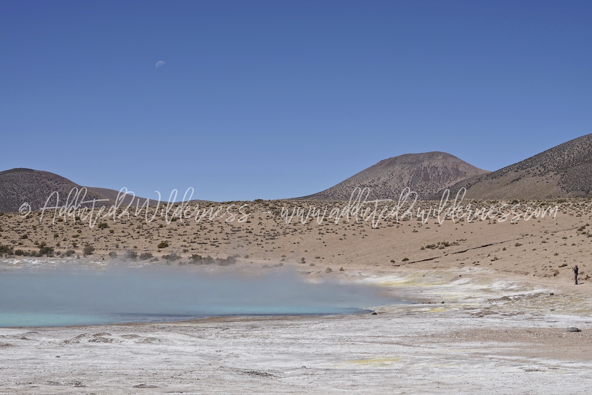
We keep on driving along the A-319 till the Termas the Polluquere and the long drive to arrive here is fully worthy. We find all for ourselves and vicunas only: steaming water pools colored of turquoise light-blue which contrasts with the thousand colors of the volcanoes and the optical white of the salar...
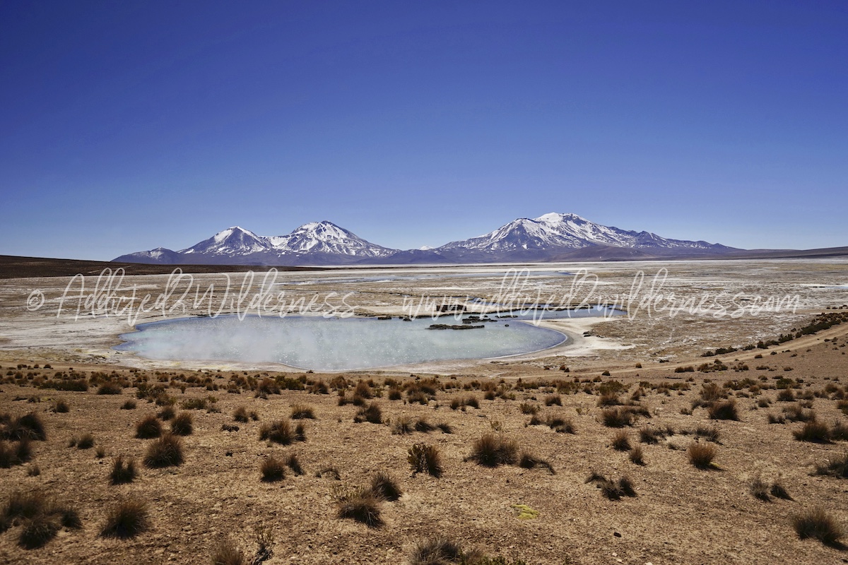
...and the moon is shining in a deep cobalt blue sky. Wonderful.
We haven't dressed the bathing suit, but we are so hungry for adventure, dusty roads, photographs, landscapes and wildlife, that after a short hike around the thermal area we jump back into our 4x4 and take the road which will bring us towards the north side of the salar, through the east side.
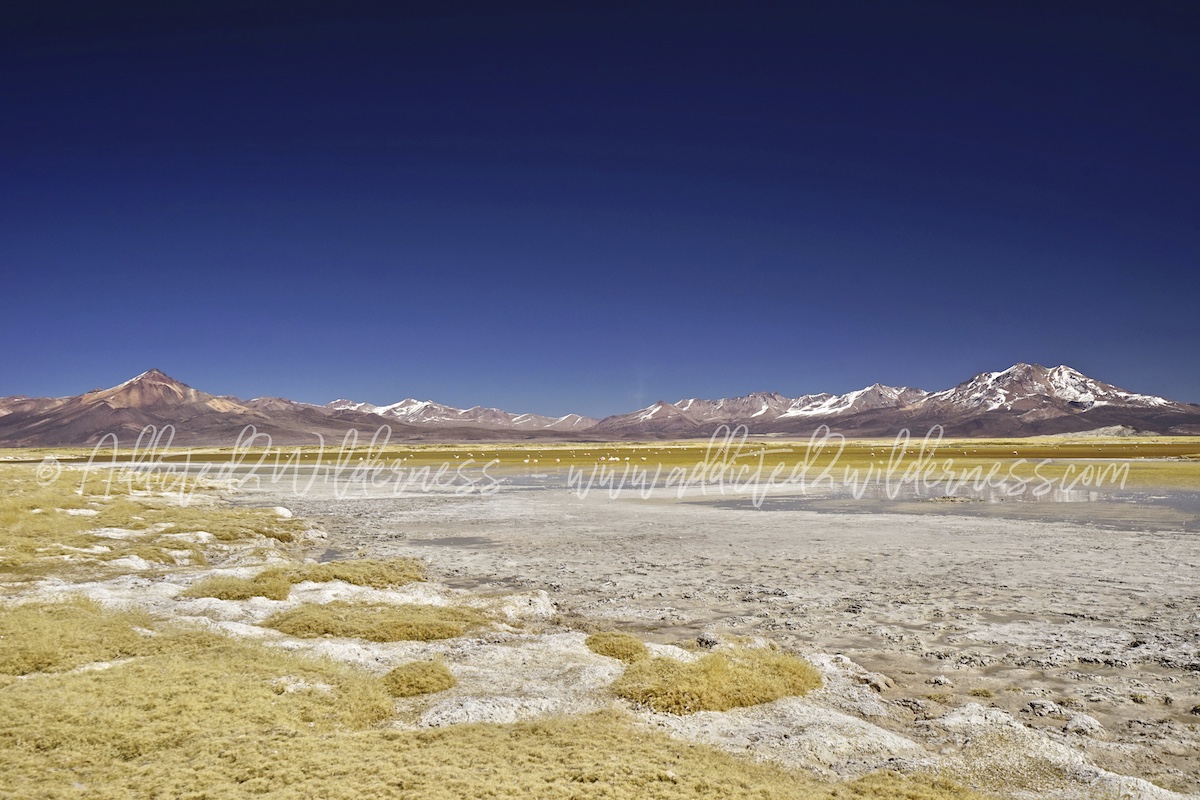
The A-253 heads to north and brings us closer and closer to flamingos. The second half of east side is amazing. The wetlands are so beautiful, Arintica is a polar star and the yellow grass mixed with the white salt brine accompanies our gaze to various species of flamingos feeding into shallow waters.
The wetlands are very sensitive environment and worldwide officially protected (Ramsar convention), therefore very high attention and respect must be paid not to spoil such gems of nature. Please pay attention where you put your feet and don't enter with your vehicle at all in such areas.
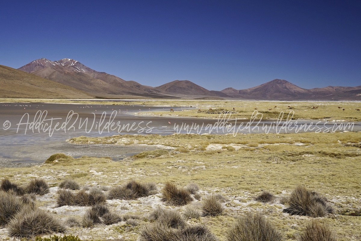
Turning left towards west we start driving along the north shore of the Salar de Surire. Wildlife is abundant as there is a larger number of fresh water-pools / lakes. It is fantastic admire so many vicunas herding and roaming freely and a massive amount of flamingos quiete close to use.
The calm and tranquillity which this immense place of uncontrollable power gifts you is far above any word we can use.
On our map (scroll above) we a couple of waypoints we defined to be a good viewpoints where to stop and take some very nice photo, but mostly to enjoy the freedom and lucky you feel by being in such stunning place. In one of this wiewpoint we take a short detour and had chance to hike for a while along the shore.
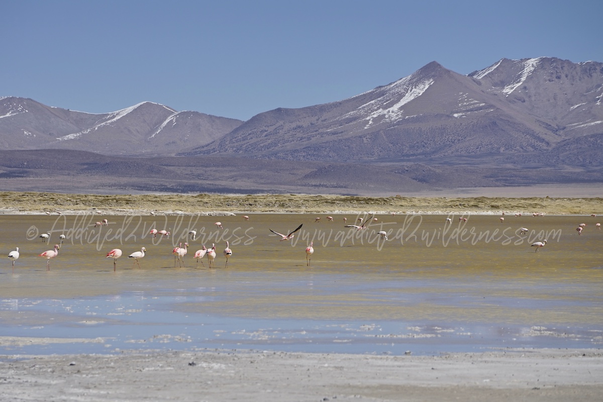
All the north side is amazing, the panorama is so beautiful, the fresh water brings a feeling a of life-plenty and indeed there are so many flamingos grazing there.
We found chance to photograph them in all the waypoints we then marked in our map, also the last section of the A-253 which drives us to the exit of the Salar de Surire (towards the Carabineros' hut / check point) offers some unmissable views.
Way back from Surire to Putre is a fight between our feelings. We are conscious we spent a wonderful day in one of the best place a wilderness lover could love to be and we realize our tour in Putre's area is at its last full day.
Don't worry, the memories of such incredible and pristine places stay with us since then and forever. Moreover our trip back cross once again amazing scenarios made by wild quebradas, ford of fresh water streams , volcanoes capped by snow, vicunas and alpacas everywhere.
Here we are, our last night in Putre. What a magic village. Once again back for the 4th straight evening to the same quaint tavern, once again consommé de alpaca, alpaca steak, pisco sour. People there is the living part of such artwork, of such vivid theater. We bring in a piece of our hearth the memory of our walks always with the backpack on the dusty roads of the village, the memory of Venezuelan waiter there in search for better lucky, the memory of ordinary food but so meaningful.
We bring the memory of Marisol, her proudness to have deep roots in those Andean pueblos, her enthusiasm to grow up an homespun family business in tourism, our breakfast in the dining room of her parents, the memory of her milk-quinoa bomb for constipation - if you forget it in the car door under the sun it is unmatched :), the funny refuel of fuel-tank with her father early in the morning, our magic tricks to get a big 4x4 pick-up passing through so narrow bystreets.
Comments
is so cool!running over rocks makes wilder
Id like to try someday