

 Amazing and powerful spirit
from Lauca to Hornocal via San Pedro de Atacama
➥ South Area - San-Pedro-Stage
Year: August 2018
Countries: Chile, Argentina
Km: 4708
Vehicle: Volkswagen Amarok 4x4
Camera: Sony A7
Directing: GPS with OpenStreetMap
Planning & arranging: Self
Driving: Self-drive
in bold location to stay
Back to first part of the journey (Putre stage)
- Calama
- -> Iquique
- -> Putre
- Parque Nacional Lauca (Cotacotani, Chungarà)
- Volcan Taapaca, Quebrada Allane, Quebrada Colpita & Suriplaza
- Volcan Guallatiri & Monumento Natural Salar de Surire
- Parinacota & other pueblos (the info about such Andean Publeos are spread around the 3 day-trips above)
Back to first part of the journey (Putre stage)
SAN PEDRO-STAGE:
...proceed on the journey: let's go to Tilcara!
TILCARA-STAGE:
- -> Paso de Jama (border-post Chile/Argentina)
- Salar de Loyoques
- Cuesta de Lipán, Salinas Grande, Purmamarca
- -> Tilcara
- Quebrada de Humahuaca & Hornocal
see here info about Atacama, what not to miss & tips in a trip to Atacama

from Putre to San Pedro de Atacama
As said we used Iquique as excellent place for a stop-over during both long drives from south to north and from north to south of Atacama.
The second stage in Iquique has been even more vibrant than the first, as we already know how to move around the city we can spend more relaxed time to have a good rest and enjoy the urban life before diving again in our trip into the wilderness.
Have we already mentioned the Pisco Sour in Iquique is addictive?! We had one of the most epic hangover of entire life. If they offer you "Pisco Sour Cathedral", please consider that "Cathedral" involves a quite huge glass (similar to the small one for white beer) of a fresh drink which is made by a quite significant part of distillate of 40% alcohol. Thanks to lime and ice you find it very refreshing and quickly drinkable as a light beer in an hot summer day. At the end of your second half glass, commencing your third glass, you will find yourself wondering if it is too much. Question will be over to quickly. Personally I forgot how I walked back to our hotel along the oceanside at night and recovery in the morning has been truly difficult.
Pisco Sour is a must to enjoy in your stay in Iquique (and everywhere in this area!). Simply, just remember this funny story when you keep on ordering it to the waiter.
|
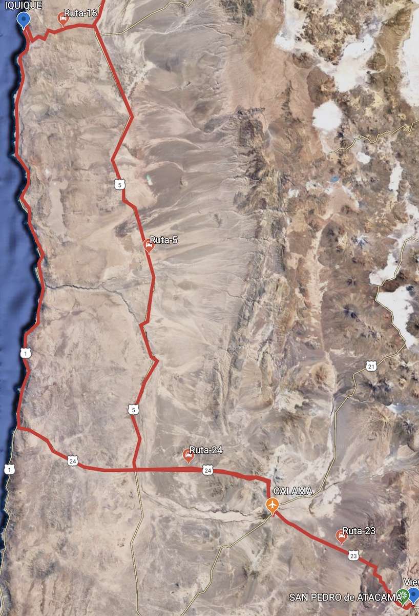
The way from Iquique to San Pedro de Atacama is 6 hours drive approx, but please allow at least one additional hour, since some few stops are needed. On our way back to south we decided to drive inland and catch the Ruta-16 and then head towards Calama on the Ruta-5, passing through the Reserva Nacional Pampa Tamarugal (nothing special). We turn left on the Ruta-24 (Calama-Tocopilla) and drive to and through Calama, then head towards south-east on the Ruta-23 towards San Pedro de Atacama. Getting closer to San Pedro the scenario becomes more and more beautiful. We know what sights were expecting us, thank to our tour here in 2014. 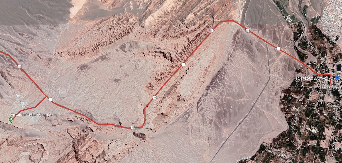 |
The first photo we post here for San Pedro may seem a bit strange, but we want to dedicate it to a friend who we found four years later our first visit. As four years ago he is always ready for pampering time and warm buns. This is the spirit of San Pedro de Atacama: live the day in freedom, everyone with own life to live, on the dusty roads where anything can happen and where everything happens.
A real artist or an improvised artist. A madman or a drunk man. A rich man, a poor man, a rich "Penny-Pincer" man, a poor "Champagne-Taste" man. An adventurer, a backpacker, an explorer, a dreamer. A man looking for luck, a merchant, a street-worker, a waiter, an innkeeper, a scientist, a photographer, a writer. A native and self-sufficient dog, no stray dog. Everything in a moment seems to have been there forever and ever. Everything seems to be able to last forever or only for the moment you are experiencing it. Tomorrow San Pedro will still be the same magical theater.

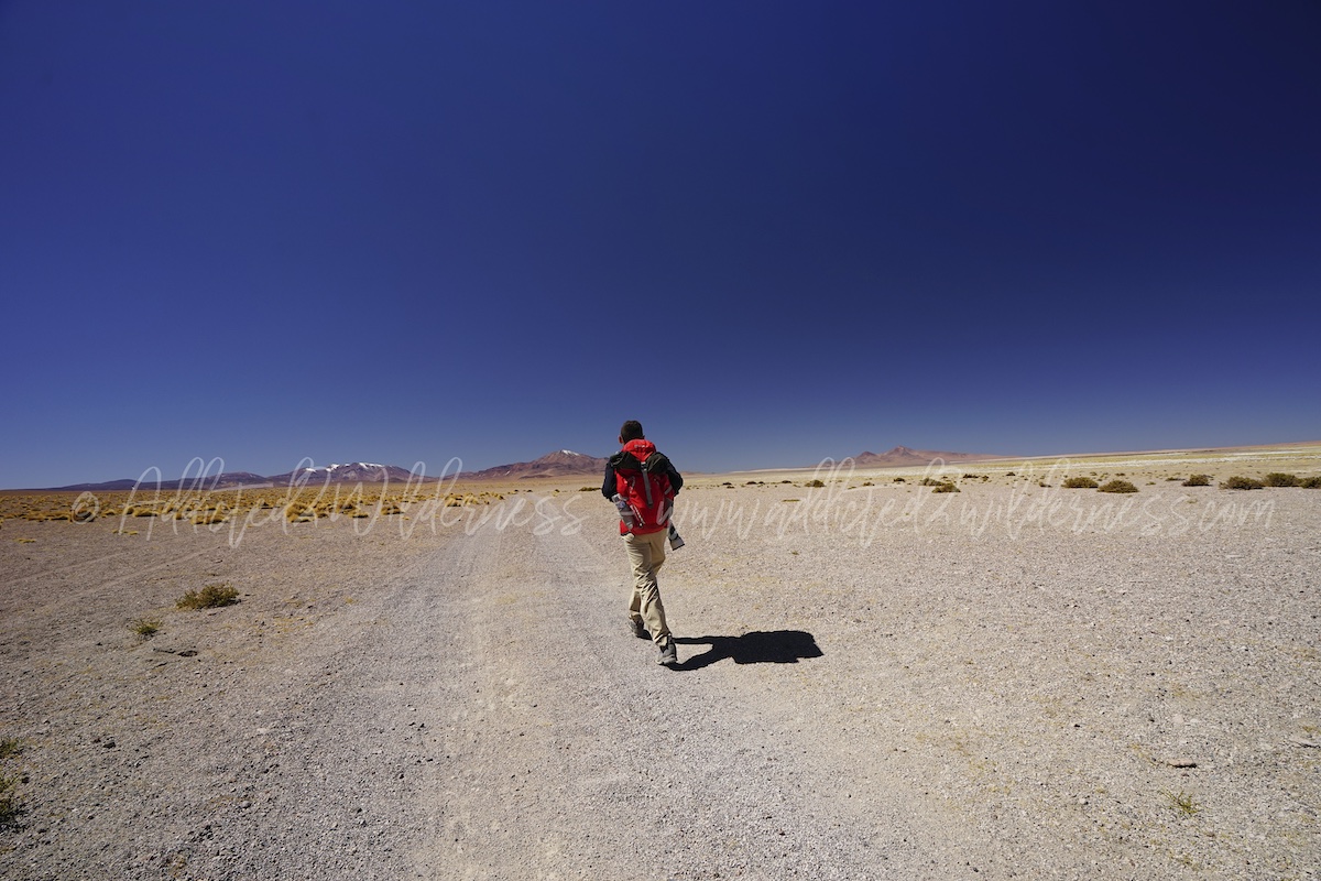
San Pedro is... San Pedro. Sometimes also San Perro :) It is a small mountain town in the middle of desert and it's a lonely border town (Chile / Bolivia / Argentina). Actually it's this and the belly button of the World. When you are in San Pedro you have the feeling to be at heart of the World. Everything and everyone, coming from everywhere. This village is with dusty bumping roads is a tourism super-star, with a vital taste always tastier than you can imagine.

Staying in San Pedro de Atacama, we have excellent access way to our exploration of the Atacama wild desert and the same a such entertaining, pleasant and top class equipped for tourism place to repair and relax back in the evening.

Nice walk in the town center even just for greetings to dogs, is always peaceful, safe and regenerating.
You can have a drink, obviously a Pisco Sour (during this trip in San Pedro we discovered the version with "Rica-Rica") while you rover around the streets looking for handcrafts and a nice place to have dinner.

In our first full day in San Pedro de Atacama, we decided to go hiking in the Valle de Marte as priority, since we have visited it just partially in our previous journey here in 2014.
We drive back on the Ruta-23 direction Calama just for few minutes and unluckily we see the first entrance gate closed. By the way our plan was already to hike entering the north west section and we actually studied the map and trails in detail and fixed the suitable waypoints on our GPS software.
Once arrived we found also this entrance gate closed. No panic, with our 4x4 we drive along a bumpy dusty track for a while and then park safely close to the trekking trails. Backpack on shoulders, with all the trekking gears ready to go (don't forget to bring with you a huge amount of water!!).
Map here below.

We quickly climb up a rocky trail and we are at the top of a plateau giving us boundless view over Andean Cordillera & Atacama Desert. We are completely alone. No one is there, all the Valle de Marte is for us only: WOW!! We keep on hiking at the top side of the plateau ridge and the views become to be more and more beautiful.

We are towering above canyons, peaks, dunes which are part of the immense panorama of the Valle de Marte. The red, orange, grey, ochre colors of the desert are painted over sandy and rocky waves. They are mixing with an impressive deep blue sky.

The skyline is outstanding, the infinite serie of volcanoes designs peaks capped of snow, stretching in front of us for hundreds of km. Just backdoor Valle de Marte, you can see the ancient Pukara de Quitor and back of it, in a small green crowd of trees, is lying San Pedro de Atacama. Behind this, as steady endless slope, the Altiplano starts to run towards the peaks and desert turns in yellow grassland, home of vicunas' herds.
Quick lunch here over such spectacular panorama and then we roll down the sand dunes, into the Valle de Marte. Over the top it could appear a short crossing, but hiking through this with hiking-boots sinking into the sand is tough and the distance is actually huge.

The sun was very hot above our heads and the core of the valley quickly turned into a furnace. There is no trail to follow, like a rover on Mars we must create our own path, just using the peaks of mountains, the sun and sometime a quick look at the GPS. Pure desert adventure. Amazing.

The valley floor is a sort of labyrinth made by sand, rocks and salt structures, where we must orient ourselves at our best to come out back at same place we left our 4x4. After a strenuous hiking of quite a few hours under a sheer-sun we make our own trail to close the loop.

It has been very challenging (but for sure not the most difficult trekking we had in our experiences), but really one the best trekking trail we have ever done. Water stocks we bring with us have been so valuable! Thanks to the loneliness gifted to us on that day in which valley was closed to commercial tourism, we had definitely an epic hiking into the wilderness.

Out of Valle de Marte, our day is just at half of the planning. Tiredness is there, but the enthusiasm is so high that we immediately set off on our way to the Valle de la Luna.
Valle de la Luna is probably the blockbuster of the tourist attractions in San Pedro de Atacama. Very close to the town, it can be reach even by bike, without facing any special steep road. Most the tourism agencies (there is a huge number in San Pedro) organize tours in the Valle de Luna as prioritized stage and the valley is also visited by a lot of "self-drive" tourists even without any special experience in off-beaten track. This means to find a fair amount of commercial-tourism in this destination, but don't worry: it is so huge and so beautiful that its magic will sweep away any concern. Frankly speaking, except a bit large flow of people coming up Duna Mayor for sunset panorama, we came through a quite low amount of people. As we are habit to enjoy loneliness and wilderness in our adventures even 2,3,4 persons sometimes may appear a crowd :)
To get at Valle de la Luna from San Pedro is quick and easy: take the Ruta-23 (Calama direction) and just few kms you will find a sign to turn left. Follow the paved road (Ruta Valle de la Luna) to the information center / entrance gate. After the gate there is one main gravel road to follow. Very easy. You can reach it by bike if you like and no slope to face.

We already had a large general visit to the Valle de la Luna in 2014 so this time we focused on some few major spots, prioritizing backpack-hiking mostly to Mirador Achaces, Mina Victoria, Duna Mayor. Here above a simple map with our trail in Valle de la Luna in 2018.
The two main famed attractions are the Duna Mayor and the Anfiteatro, but in general you can enjoy a very easy tour in the desert catching astonishing panoramas.

Valle de la Luna is full of magnificent views, wherever you look you can admire the wonderful scenario of the valley itself or the memorable view of Andean Cordillera stretching above the dunes and the amazing salt-rock formations of this desert-valley.
The view at the sunset, on Licancabur volcano painted of pink, orange and purple, capped by snow, is probably one of the best sights you will ever see in your life, even traveling all around the World.

The trekking paths in the Valle de la Luna are quite well marked. Sometimes the paths go up quite steep but they are usually not long. In a short time you find yourself in a good position to enjoy fantastic views of the valleys below. Then, once you are at the top of the ridges, you can move quite freely over the summit. Obviously respect of environment, eventual restrictions about walking areas and basic rules of safety must be respected.
It is accessible to all the commercial-tourists coming to San Pedro (no issue about the altitude sickness as well) and it is a soft & relaxing destination for the most wilderness addicted voyagers, let’s say this venue is a prêt-à-porter wilderness adventure. No minus at all to this magic place, one of most beautiful natural landscape we have ever seen.

Mirador Achaces is a worthy and short hiking trail (allow 30 minutes walk) and the scenario while we climb up to the ridge is really nice, with a very beautiful sight on the back side of Anfiteatro and Licancabur as well.

Duna Mayor is a must to be at sunset time. We climb up quickly (steep but short walk) to pass over asap the flow of people coming here to take a nice photo or just a selfie (this is probably of the most famous and popular iconic sight of San Pedro de Atacama). Once up to the top of the ridge, we walk around enjoying the view at 360°, but he juicy-part comes after the crowd of people goes away, as they've come just for a quick memory.

Now we can taste an immense warm sun, which is preparing to sleep back to the endless Andean Cordillera and playing with the desert formations to design amazing shadows. Stay there, wait at the the summit of the dune, take your time. You will be fully rewarded.
The Valle de la Luna is an easy accessible destination few minutes far from San Pedro; so there is no reason to rush for safety reason when light is starting to go down (by the way check official closing time of the gates).

Well one reason to stay not too late is there actually. We remember it very clearly since 2014. It's while we drive back to San Pedro on the way to the exit gate.

We come across an astonishing sunset over the road down ending against the majestic Licancabur and all the other volcanoes; they are fully pinked and towering on the immense flat-land of the salar and moon is shining high in the deep dark blue sky. This is an indelible memory.
A short funny story: climbing down after sunset on the Duna Mayor, arrived at our 4x4 we find another one with car license plate from Argentina just next to ours. Something in our head starts buzzing: may it be the 4x4 of the guy with whom we had together an epic crossed of Salar de Antofalla in convoy 4 years ago, in the adventure drive from El Penon to Tolar Grande? No way!! Incredible, it is!! We met Federico by chance 4 years later. Greetings to Federico and promise then maintained by him to bring our greetings to Teofila (you will read about her in our 2014 trip at Tolar stage). Amazing how sometimes the World and life are.
Piedras Rojas, Lagunas Aguas Calientes (Talar) and Tuyaito

If you wake up and it is promising to be a sunny day in winter in Atacama (it is usually at 99%), despite the cold temperature at breakfast time, it is really likely you will find yourself dressing a t-shirt during the day, as the sun hits hot at such altitude, even more with the impressive clean sky of the Altiplano.
This is the nice easy thing; by the way don't miss to consider to leave your lodge without adeguate equipment to face the full day. If you are going to have a day-trip with a bit of trekking over the mountains, in most parts of the World you will probably bring as additional garment a waterproof jacket.
Ok, here you are in the desert, where the difference in temperature between day and night are huge. Add to this the extremely high altitude, quite possible strong wind, lonely places, offbeaten tracks. You will have to bring with you all the necessary to face the unpredictable: strong wind, suddenly cold (icing) conditions, garments and equipments suitable to save your life in case you fall into an emergency and stay out overnight (it's quite unlikely to stay out overnight and being able to tell the history!).
Briefly, to simplify: one of us missed to bring the heavy jacket the day of our trip to to Piedras Rojas and as result the other one gifted his one and arranged himself with the blankets we keep for overnight emergency in our vehicle. The chilly wind and freezing temperature at Laguna de Aguas Calientes were undescribable. Who was the one missing the jacket and who the one gifting it???

By the way, we embarked in our 2nd day-tour heading to south, driving on the Ruta-23 towards Paso Sico. This paved road could be considered similar to an expressway, which runs in between the ridge of Andean volcans chain an the Salar de Atacama.

The panorama is wonderful, this year (2018) even more, thanks to quite large quantity of snow still there around. The snow is not only capping the summits of volcanoes and some plains along their ridges, but the magic is generated by the feeding power such melting snow has on the nature and its life. Grass and bushes are blossoming thanks to the various streams and ephemeral water-mirrors spread all over the Altiplano.
To reach the Mirador de Auguas Calientes from San Pedro it takes approx 3h, but actually a bit more as the way is so beautiful and crowded of nice sights and vicunas herds, both to catch with the photocamera.

In 2014 we had dedicated a trip and hike to Miscanti & Miniques lagoons, which are truly worthy (a must to visit in a journey to Atacama), but this time, despite they are along our way on the Ruta 23, we decided to head to Piedras Rojas, as we have missed it in our previous travel here. Passing through the villages of Toconao and Socaire, you can taste the feeling of common life in Atacama and relevant habits. We will be back later to Socaire, which has been an amazing stop-over during our way back.
Passed the Pueblo of Socaire, the road start to climb and the landscape around us awesome, water flowing through red stones, green and yellow grasslands ending up against the colored volcanoes summits, while the snow is progressively increasing its presence all over around us.
After few bends the straight section of the Ruta-23, which driving us alongside the Miscanti & Miniques, starts to reaveal us such fairy panoramas even more. We find ourselves stopping along the road several times to take photos, as we are fascinated by the scenario around us and being alone to enjoy it along such road runnig on the roof of the World.

In July and beginning of August, as our travel to Atacama was approaching we monitored the weather and specifically the snow conditions and we were aware it was a quite exception year that one. Massive snowfalls occurred and several road were closed (i.e. road to Paso Sico). Having this in mind, we started to realize that we could find some ways, some hiking trails or some viewpoints closed due to snow on the ground. Indeed, it was the case. Don't worry, the magic the such snow melting gifted us was much larger that the limites which generated.
Herds of vicunas are roaming freely everywhere and we stop just park our 4x4 out the roadway to admire them and go hiking close to them.

Miniques and Miscanti volcanoes are towering close to us and the snowed grassland there around seems to be a lonely edge of the World out of any age.

Few kilometers further, almost arrived down to the plain where Salar de Aguas Calientes is lying, there is a very nice viewpoint just at left of the Ruta-23. We parked the car and reamin astonished about the panorama over such endless volcanoes kindgom marking the border with Argentina. - see viewpoint we marked on the map above -

Unfortunately, arrived at the Piedras Rojas, we had difficulties to identify the track leading to it, as the snow was covering the ground. We found staff / stewards probably for environmental protection and/or mostly for tourists safety, who we preventing visitors (including ourselves) to approach the lagoon shores. They were quite stricy to patrol all the area (from Piedras Rojas to Mirador to Aguas Calientes to Laguna de Tuyaito). Therefore, as result we missed once again to visit and take photos to Piedras Rojas (we already missed in 2014). By the way we enjoyed the sights on the Laguna de Aguas Calientes where ice, snow, fresh waters, colored stones and sands were perfectly mixing, were memorable.

As above mentioned, the wind at the Mirador Aguas Calientes was impressively beautiful, but we remain just for a while as the wind was so strong and chilly that we cannot resist for longer.

We proceeded just a bit further till Laguna de Tuyaito, where the road was definitely closed for safety reason. As the flow of people traveling there to visit the has to stop at the really beginning of the salar area, there is a bit too much people to enjoy the place as it deserve, therefore we just take some photos and catch out way back. Laguna de Tuyaito sigth seemed to us nicer from Ruta-23 coming from Paso Sico (our trip 2014), rather than coming from San Pedro (our trip 2018). Don't know if this was due to people, road closed or mantle of snow covering almost all the colors there around. A trip along Ruta-23 from San Pedro de Atacama towards Paso Sico is a must: the travel itself is fantastic and the area around Piedras Rojas and Salar / Laguna de Aguas Caliente gifts incredible sights. Moreover you can come across multiples to destinations such as Miscanti & Miniques (hike there around the blue lakes with vicunas, andean foxes, etc. is amazing), Socaire, Lascar, etc. You can plan a wonderful round trip.
On our way back we stop for lunch at Socaire...?
Socaire is a small pueblo lying on Ruta-23, approx 100 km far from San Pedro de Atacama. It is where the road B-365 climbs up from Ruta-23 towards Laguna Lejia and Salar / Laguna de Aguas Calientes (not be be confused with the homonym Salar / Laguna de Aguas Calientes, also called Talar, located a bit southern close to the Piedras Rojas along the Ruta-23). Our plan was a very quick stop here in Socaire and then to reach Laguna Lejia through the shorter road B-365, rather than the B-357 we actually took, via Talabre. We decided for this second road, since in Socaire they advised against the B-365 as in very bad condition.

We arrived in Socaire driving on the Ruta-23 towards San Pedro from Piedras Rojas, which is approx 60 km far away from this pueblo. The scenario we pass through driving back on the Ruta-23 is wonderful and it would deserve so many stops to take photos or to spend time hiking over the mountains' slopes.

Our stop-over in Socaire became a short walk around for the village and then a lunch-break in a scruffy but memorable tavern, with seats along the Ruta-23 and panorama on the Lascar volcano.

When we decided to move ahead after our lunch, they closed the road... and the village festival begins. It has been fantastic!
Quebrada de Talabre & Volcan Lascar
On our second full day in San Pedro de Atacama, we had on our plan to visit also the Laguna Lejia. We missed to visit this shallow-water salt-lake in our journey here in 2014.
Lejia lies behind the majestic active Volcan Lascar, known as El Grande Lascar, which is one of the most active volcano of the area. The way to Laguna Lejia is through a track at high-altitude: it is the gravel-road and almost unknown "Cruce Ruta C-23 / Paso Huaitiquina" also named B-357 (view map above). This track passes along volcano's ridge, heading towards the lonely pass "Paso Huatiquina" or towards lagunas Aguas Caliente & Talar.

This trip was sounding mythical and exciting, therefore we setted this as a must thing to do in our second tour here.
Due to limitations imposed by snow conditions and environmental restrictions in place around the area of Piedras Rojas, despite this attraction is located quite far away from San Pedro, we had enough time to take the detour towards Talabre and head towards the Lascar volcano, with destination to Laguna Lejia.
We had an amazing lunch-break at Socaire, then we find ourselves on the B-357 (Ruta C-23 / Paso Huaitiquina). Panorama is wonderful.

The first section of this road is paved and in good condition. This till Talabre and also a bit further it.
We had already driven on this road in 2014, as we visited Quebrada de Kezala, where we had a nice hiking time, admiring the petroglyphs into the canyon.
The view on all the countless volcanoes' summits is wonderful and Altiplano become more and more attractive ever meter of altitude you gain driving up along the road. Turning into the gravel road, proceeding along the Quebrada de Talabres, passing through Talabre Vejio towards Tumbre the landscape around us is outstanding. Vicunas, burros (donkeys), Llamas, Alpacas and various birds are inhabitating the area.
 We are completely alone admiring the Volcan Lascar, which is a looming and fascinating presence, almost mystical in its massive silohuette.
 Along the plateau bordering the Lascar, approx half way from Tumbre to Lejia, we come accross a young couple walking lone along the gravel track in direction towards Tumbre. We are extremely surprise to see someone walking there, even more they visibly seem not to be there to ejoy trekking.
Approaching, they started to raise up and shake the hands, asking us to stop. At first stage we look at ourselves and we tought it is not a good idea to stop and give a lift to completely unknown people roaming in the middle of desert at more than 4000 meters altitude, under an active volcano at mid afternoon, hundred of km far from town. We slow down and keep our multipurpose knife promptly accessible. They tell us to be Brazilian tourist, having their car stuck ahead in the snow. The car is not visible at the horizon and asking them details it seems they have no idea about the environment, context and relevant risks about their situation. They tell us they are walking back to reach the first village to ask for an aid to tow their car. What??!! If they are lucky, they can find someone in Talabre.
This means approx 25 km hiking back on the gravel track.
 Sunset is approaching and temperature at night there could be extremely far down the zero. Are they really gambling with high-mountain & desert? Do they seriously have no idea what they are doing or are they cheating with us and it is a swindle?

With proper caution we try to collect further information from them. They tell us their own car (not rental) is an Amarok 4x4 (like the one we are driving, except theirs is automatic) and this increase even more our doubt: there is no significant snow and no snow at all on the road; with a 4x4 like that one, we don't see credible to remain stuck in snow or into loose terrain there around, at least considering the capabilities who must have someone adventuring in such places.

Some further questions and we understand they are really rookie in wilderness travel on off-beaten tracks. A quick comparision between us in a low voice and we decide to get them on board; as they would have no chance to survive with night approaching, if they keep on walking at such altitude for so many kms, considering they have no adeguate equipment.

It has been less than 1km, but it has seemed us much longer, as their vehicle was not becoming visible. We arrived up at summit of an hill, where the road bends; there is their 4x4 perpedicular to the track. The snow is very low, just very little under the front left wheel. Very strange; we are a bit concerned and we get back to be worried about the veracity of their history. Well, they were saying the truth. They were in panic, they probably have driven their 4x4 only on paved city roads; as they were not aware even of some 4x4 functions of their vehicle. Ok, don't worry: our drive experience in Atacama loose and gravel terreains, Namibian gravel and sandy soils, Botswana deep sand tracks, Kaibab forest snowed track and many others marked significantly our know-how in difficult track driving.

We parked few hundred meters down the hill our vehicle and locked it safely. One of us jumped on their 4x4 and the other one give some instruction to pull the car around. Disabled the automatic gearbox, then a quick off for differential lock and low-gears. Their vehicle is quickly unstuck and ready to be driven down the hill. They were excited and grateful. A little bit still in panic, they asked us to drive it also down that hill as well. Many many thanks and Brazilian chocolates as thanksgiving to us for such rescue. Nice and well done (another one rescue to record in agenda after the Dutch couple in Botswana!). Completed the rescue, it's too late for us to reach the Lejia lagoon, as in winter the sunset is quite early and we don't want to risk to be late and drive back with the dark. We decide to take it easy and enjoy the rest of our day with relaxed time taking photos along the way back to San Pedro de Atacama. We missed our destination, but it has been a really cool memorable day.

Actually we discovered this place in 2014, when we were in transit from San Pedro to El Tatio Geyser.
It seemed to us a magic place at that time, therefore we promised ourselves to be back there one day in the future, to discover in an extensive way what’s beyond at glance.
This time in our 2018 trip we decided to drop the visit to El Tatio Geyser (a key-point in a “standard” tour to San Pedro de Atacama) and embark ourselves in a full day trip dedicated to the fairy-land crafted by the Volcan Putana - check eventual alerts about the volcano before to leave for this trip.(here below general map from San Pedro to Vado Putana - if no stop along the road, please allow 1h30' approx)

Just outside San Pedro de Atacama, we take the B-245 and the road starts to climb up the Altiplano quite fast. Quickly we are at Guatin village and entered the Quebrada de Jorquencal / Escalera. Taking the road on our right side we would have come across the Termas de Puritama, which we have actually missed to visit in 2014 as well. At this stage you have already learnt we are more incline to hike for several kms rather than a relaxing warm bath (despite in the completely wild desert). So that, let’s go ahead straightly towards our focus: to spend as much time as possible hiking in the Vega de Putana, commencing our trail at the Vado Putana. (here below a zoom on map, around Guatin; the "Viewpoint on Salar de Atacama" is easier to catch on the way back)

The landscape we can enjoy traveling on such gravel road is outstanding. Once at the summit of quebrada over Guatin, the scenario in the rear-mirror is impressive, with all the volcanoes stretching in an infinite row along the Salar de Atacama. Everything close to us is not less than this. Approaching to Machuca, very small lagoons fed by Rio Grande are crystalline water-pools where Andean goose, vicunas, flamingos and multiple other animals have their venue to graze.
A quick jump off our vehicle as to take some nice photos and walk along the bank of the water. Back to drive into our 4x4 we come across the Brazilian couple we saved from being stuck at Lascar’s range. What a huge small World. Today they safely smiling: probably they are coming back from their self drive trip to El Tatio, which is safer and easier to manage than Lascar...and now they are also more confident in the capabilities of their car and aware of the magic power of the differential lock! ?
(here below a zoom on map, around Machuca; "Viewpoint Vicunas" is just a grass ridge in the Rio Grande Quebrada, very next to the road, where we admired vicunas very closely - see photos below)

The dusty gravel road (quite good conditions) fords over the water-pools of Rio Grande and drives us past the nice pueblo of Machuca (we are going to stop here later in our way back to San Pedro). The B-245 ramps up on quite steep along the Rio Grande, which is a very nice clean fresh water stream, with grass banks, where small herds of vicunas come down to feed (we will meet quite a few of herds here in our way back towards Machuca).

Past the source of Rio Grande we are landing progressively on the Altiplano, the view in front of us becomes bigger and bigger, almost endless till to the volcanoes bordering with Bolivia. Up to there, we can see only snow-spotted low desert hills and some few flat grasslands.
The waypoint we marked on our GPS since 2014 is now approaching, we are almost arrived at the road bends over the Vado Putana. We see on our right side the Volcan Putana towering over this entire section of Altiplano. We decide to leave the B-245 and take an unmarked gravel trail. (here below zoom on map, around Vado Putana; the "Viewpoint" on the B-265 is a lay-by area, along the road with wonderful sight; the one marked "Viewpoint Vado Putana" is where we took amazing photos in our 2014 trip. The green line is our hiking trail, all the spots marked and the trail as well are fully "not to miss").

A painful accidental injury while we are picking up our trekking stuffs from the car doesn't stop us at all (instant ice pack is always a useful tool; remember to always bring it in the emergency box in your backpack). In few minutes we are hiking using a bit the summit of Putana volcano as a polar star and a bit the GPS map to walk into the direction where the watered part of the Vega de Putana is supposed to be lying.
We walk across the Río Incahuasi with boots in the shallow water and we remain admired from the painting in front of us: snow, colors and flexuous lines design a corner of caledoscopic desert.

We start to see the Putana is becoming more and more majestic. We draw our own hiking trail roaming a bit on the desert for a while and then, climbing up a last pebbly hill; there it is! The Vega the Putana is lying down in front us, just at lower hill layer we can contemplate this gorgeous world. It seems to be unreal, it is something came out from a fairy tale.

The Volcan Putana is the lord of the valley while it is puffing strongly into the deep blue sky. It is like a such powerful god of this alien world.
Herds and herds of vicunas are grazing in a such peaceful calm.

Being there, living into this picture, breathing this endless clash where placidity and destructive power coexist, is a turmoil of emotions, so difficult to explain.

Charmed by the sights around us we have quick break for lunch, without stopping from taking photos and photos. We keep on walking along the banks of the vega and the Andean gaviotas (Andean seagulls) are hovering and shouting above us and vicunas to push both out of their nesting areas. We do remember them since 2014 as probably one of the best photogenic subject and probably they are. We roam freely over the pebbly hills without any specific destinations, but orienting us with summit of Putana. What a wonderful world.

After hours spent hiking there around we noticed a pick-up really far away on the opposite bank of the lagoon, close to the B-245. It seems that someone is looking at us, as per the twinkle of the sun probably coming from binoculars. With our telephoto we keep on doing the same while moving around. Approx half hour later passed with this curious ballet of looks, the pick-up approached us. The driver invited us (frankly without giving choice to us) to leave the area. The guy is a scientist researcher working there to collect Vega Putana's water data with the aim to monitor Putana volcano's activity. He was really concerned about the fact that someone could approach his research instruments installed in the Vega and sabotate them or steal them. Obviously right then and there it sounds ridiculous to us.
Such wonderful place is a natural place open to everyone. No emergency alert in place. Frankly there is no reason why we should leave away.
By the way, we can also figure out his concern and how much significant are the cost and the effort linked to his work. Actually it is a very important work to be done.
We don't want to jeopardize the wonderful emotions we lived starting arguments with him. Really no sense.
He offered us a lift on his pick up to go back to our 4x4. Accepting to come back to our car, we make him happy. At the same on the way back we get some curiosities about volcanoes monitoring activity. It's always cool to meet people from which you can learn something.
We still have some few hours available in our day trip, so that we decide to drive just a short ahead towards the Vado Putana as we remember very nice sights for our photos. Indeed it is confirmed: they are wonderful sights!
We park there and contemplate for a while, once again this magical place. A gaviota approach us to gif us a further memorable sight.

Now it's time for the second half of our roundtrip drive. We head back towards San Pedro de Atacama, with a stage planned in Machuca. As happened years ago in our trip to El Tatio, the Andean seagull embarked in the trip and follows us along our way back, till our stop in Machuca.
The slope down along the banks of Rio Grande is gifting us very close meeting with several vicunas.

Arrived in Machuca in the early afternoon, we discover that the pueblo is almost complete desert, as it gets alive during the window of time in which the tourist flow is getting back from El Tatio. Basically they have established and organized their business related to the local agencies' tours, which have a standard format: leaving from San Pedro very early in the morning, visit to El Tatio, stop-over at Machuca for lunch.
Don't worry, we are missing something to scrunch, but on the contrary we have all the village and nearby hills only for us, to walk around.
Machuca is a picturesque village, with surroundings which are plenty of glut colors, with the typical Andean church with bell-tower with straw roof.

We walk up to the church and further over the hill on back. We climb for a while a bit along the hiking trail which would then bring to down into the Rio Grande's quebrada up to the pueblo of Rio Grande (which we visited in 2014). Unfortunately we don't have enough time to embark for the full hiking trail Machuca - Rio Grande (it requires also to consider the way back to Machuca); therefore we enjoy the surroundings, take some photos of the nice sights.

The drive on the B-245 direction to San Pedro de Atacama is so beautiful: in our travel we have in front of us an astonishing panorama designed by the Andean Cordillera stretching along the Salar de Atacama. Around us, vicunas and cute curious burros, roaming freely over red rocks dotty by yellow-green bushes.

We can easily recognize each volcano shape by shape, along the horizon as long till where our eyes could see. (see viewpoint marked on the map above).
Let's go the vibrant night in San Pedro is waiting for us, for a Pisco Sour as sundowner and a good Chilean Cabernet for dinner! ?
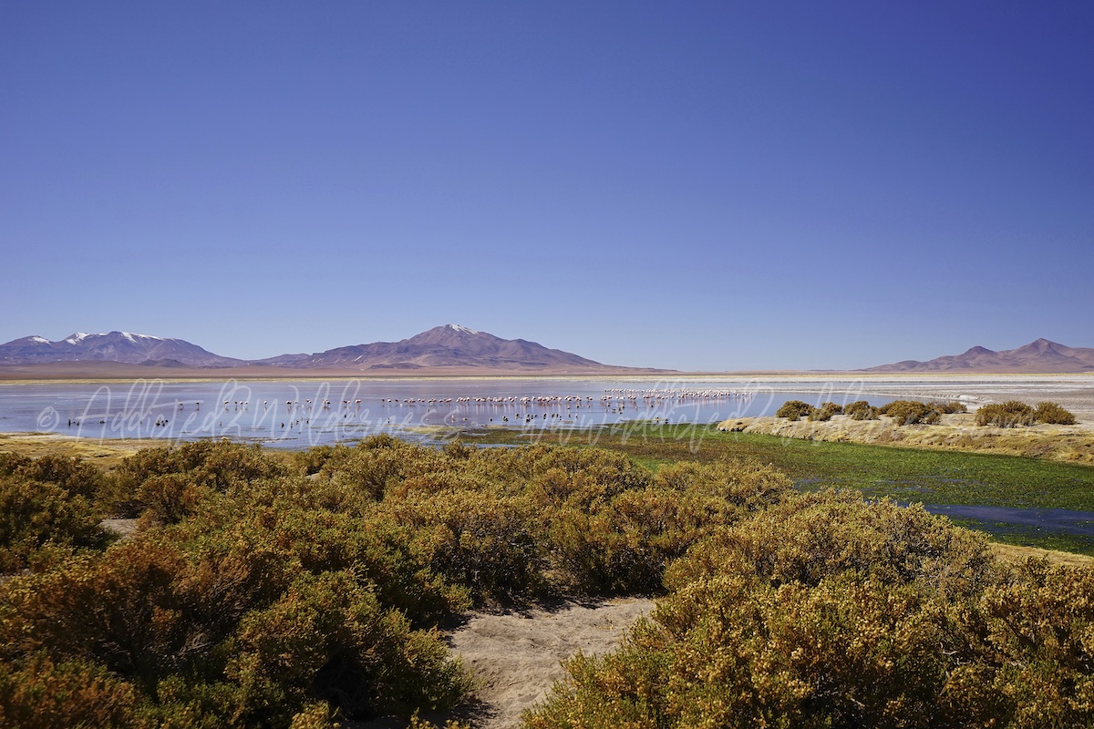
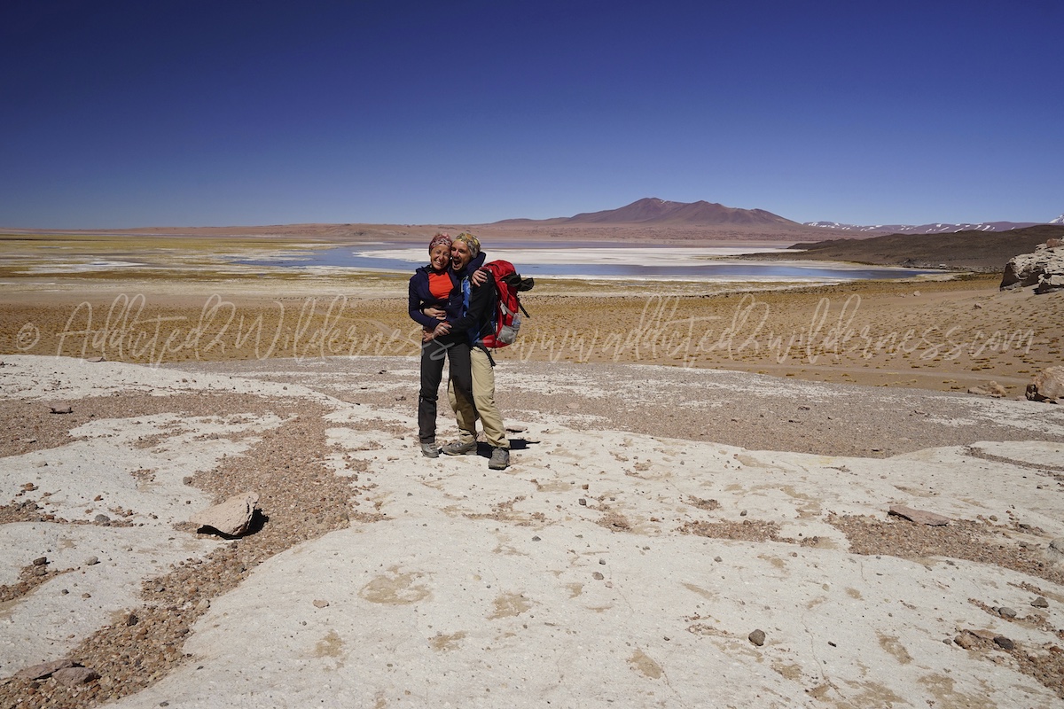
We believe Salar de Tara is one of the superstar of a travel to Atacama. It is for the incredible sense of remoteness from everything else in the World. It is for the pure taste of wilderness. It is for the lonely and astonishing beauty of its panoramas. It's for the life, which crowds this magic corner of desert. It's for the flamingos' big flocks, the geese, the ducks, the andean gulls, the coots, the plovers, the various curious rodents, the grazing vicunas, the wandering foxes.

The snow may interrupt some sections and turns around to bypass it may be necessary, along an almost unknown and rough and strenous path.
The excitement and adrenaline of having crossed the desert off-road, driving inside the Pacana supervolcano, one of the largest calderas in the world, along with the above gives you an emotion that you will carry within your whole life.

Stopping in front of such a sublime greatness of nature, makes you remain silently shocked and in tears for emotions that, unfortunately or fortunately, can neither be explained nor understood, except by experiencing them firsthand.
Since we were completely alone along all the 4x4 track as well in our hike, "our" Salar de Tara it's one of really few places visited in life, which gifts you such huge feeling.

Salar de Tara is a destination for a full one day trip to be done from San Pedro, heading on Ruta-27 towards Paso de Jama.
Please note: visiting the Salar de Tara will bring you up to 5000 meters above sea level, therefore altitude sickness may occur.
Moines de Pacana are at approx 100 km far from San Pedro and it is 1 hour drive if you go straightly without stops.

It will take a bit more, since there are so many wonderful panoramas along the road. As soon as the Ruta-27 starts the be closer the Licancabur we have the feeling to be into the magic of fairy landscape.

All the road section with bends from there up to Portuezelo del Cajon area (Bolivia border) gifts amazing views all around us: on the backside we have the huge Salar de Atacama and on the other 270° we have volcanoes, grasslands, lagunas, which are creating a patchwork with snow. Vicunas, llamas and alpacas are grazing freely.

You can enjoy from the Ruta-27 the view on the Laguna Verde and Laguna Blanca, lying in Bolivia just under Licancabur and Juriques slopes. The landscape there is unreal. Wonderful. If you have time don't miss a day trip from San Pedro to Laguna Colorada in Boliva. You will pass through Eduardo Avaroa Reserve, which is commencing at the border with Chile (including the Lagunas above mentioned and the astonishing Dalì Desert).
Climbed up on this section of Ruta-27 we have the feeling to have accessed to alien world. Something away from our planet, something which is lying beyond natural gates and which hasn't been discovered yet.
We had a stop at Quebrada de Quepiaco, to enjoy wonderful sights on this small wetlands, where various vicunas herds are grazing in tranquillity.
Snow and ice are still strongly present, as the season just before our transit has been rich of snowfalls and temperature are still slow in the early morning (we left San Pedro de Atacama at 6am approx).
Don't miss to bring with you everything useful, such as: emergency, food, water and equipment to face umpredictable events, as Salar de Tara is a complete remote place and if you get lost or remain stuck you literally have to manage a way to survive as a cast away, at least overnight where temperatures are extremely low.
When we start to see the Laguna Aguas Calientes and the Moines the Pacana, we know that after the strict bend on the Ruta-27 there is the 4x4 access to the Moines the Pacana area (see on the map below).

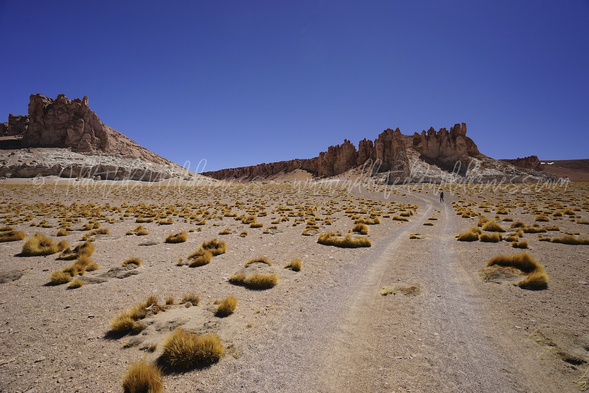
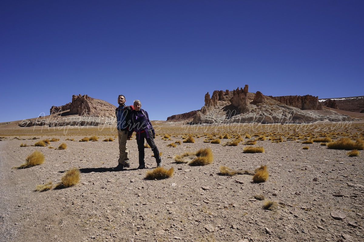
We did rember well this panorama, stretching all over the Andean summits till Argentina, plenty of vivid colors. Moines are standing there; they are molded by the wind and by the time. This immense semiflat depression is just a small wonderful part of the Pacana Caldera.

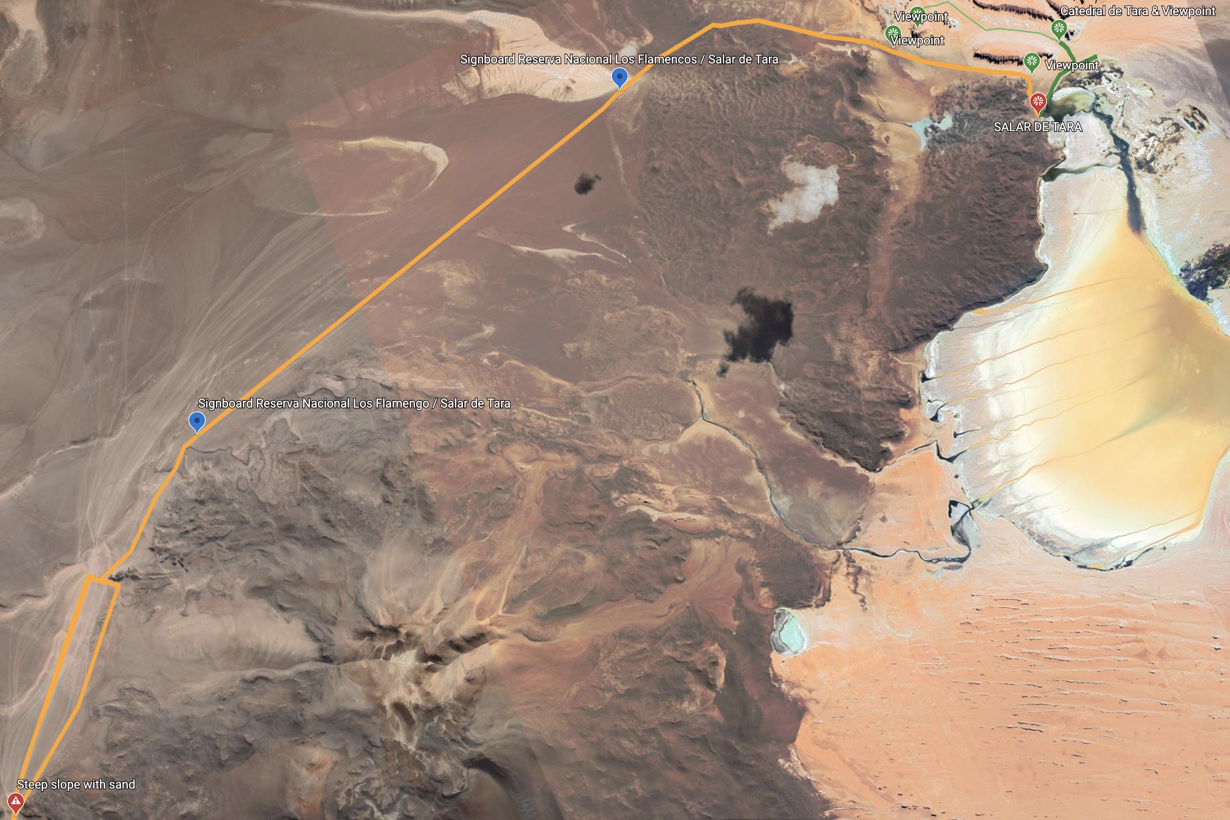
The challenging part of the track to Salar de Tara starts after the visit to Moines the Pacana, where we enjoyed to hike around (see green track on map above).
Track is commencing to be less clearly visible and more over it pass through loose terrains and step passages, narrowed by rocks and sand. As tire marks are spread around, it's difficult to find out the best way to avoid to remain stuck or to somersault.
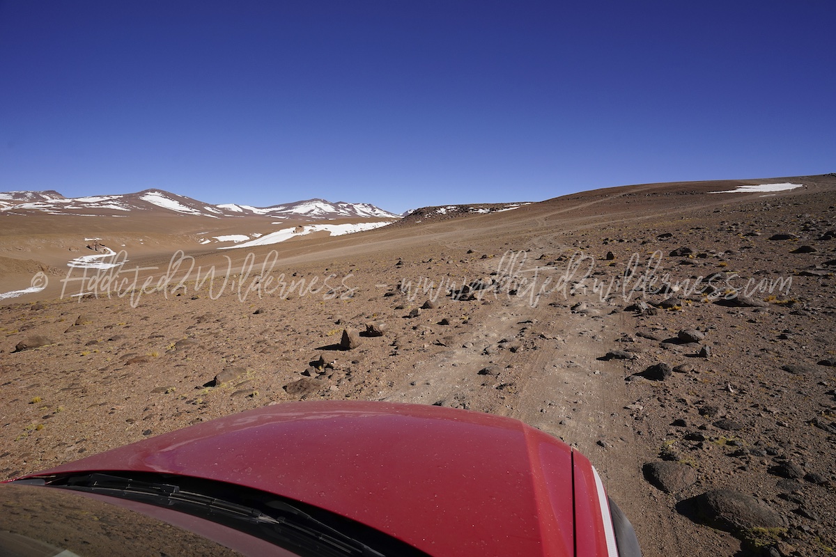
Past the first section (from Ruta-27 up to the steep slope marked on map above), we have driven on top on wavy and bumpy track staying close to ridge of gravel hills. We did this in order to avoid lower tracks with loose terrains, even if with more tyre marks visible. The 2nd part of our track to Salar de Tara, which we identify as the section running between the two signboard here below on maps, is an amazing drive on completely flat terrain, covered by small gravel. Temptation to go fast here is endearing, but you must pay really high attention. Risk of accident, risk to remain stuck or risk to get lost are very high. We must follow our waypoints and the gps track (which we planned very carefully) and, at the same time, we must proceed fast enough to let our 4x4 flow over the terrain to avoid to silt.
It's amazing to drive on this plain section, as you feel to have the whole Pacana caldera for yourself. You can push on the gas a bit more and target straightly the destination: Salar de Tara!
The track is perfectly linear, but as without much key reference points, it could be easier to get lost. Pay attention to your gps.
It tooks a while in 4th-5th gear and then, after climbing up a slope and bending to right, you enter in the very last section of the track leading you to Salar de Tara shore.
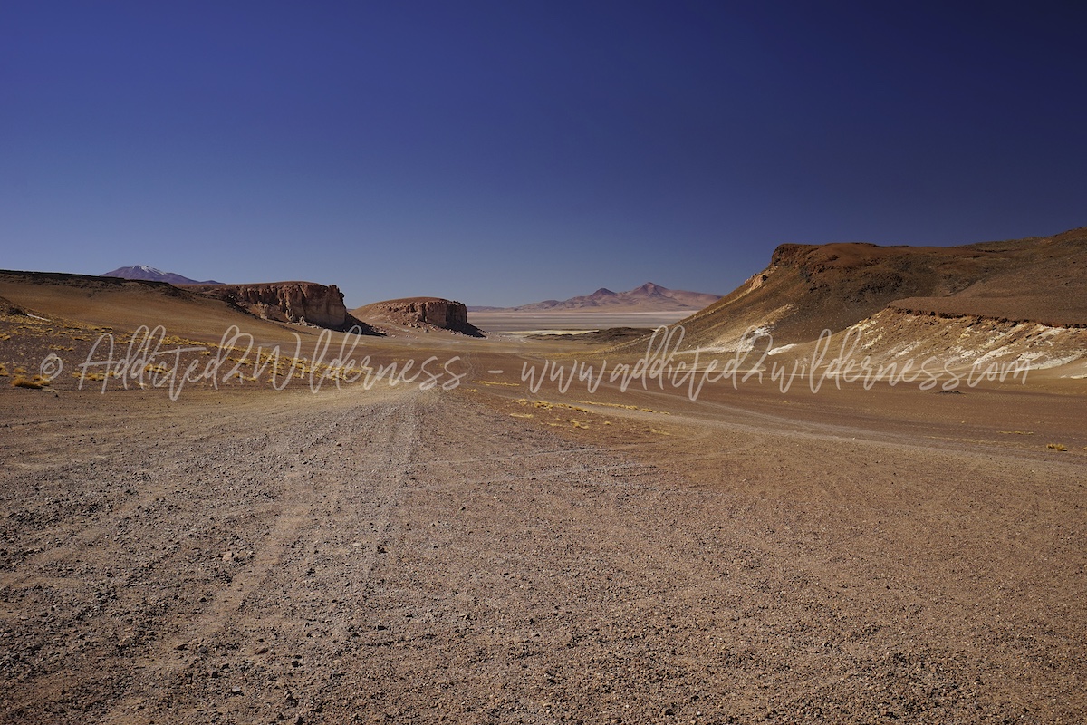
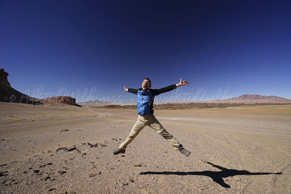
The panorama which opens in front of us is astonishing. Despite we already know it, we remain admired by so big beauty. We are arrived, the most difficult part has been driven, now it is just like landind down to the shore.
Arrived in proximity to Catedral's rock formations there are various track options to drive down towards the Salar de Tara. The best and probably is the one keeping the Catedral on the left, proceeding straight ahead along the track we are on. In a short the track start to slope down and the view in front of us becomes more and more wonderful. Vicunas running along the shore and the big flocks of flamingos are dancing very close the shore. As a frame of this scene, the beauty of the Salar, the Catedral and the endless volcanoes. The live picture of this place is incredible. Astonishing.

One of us proceed on foot and take photos and the other one drive the vehicle with engine turned of not to disturb the fauna, till donw to the shore.

We remain a bit of time standing up in silence to fill ourselves of such immense pleasure and then we embark in our hike along the shore. The very first part of trail is quite easy to follow as quite well marked by rock positioned along it. It stretches along the north-west shore, from Conaf hut towards the Catedral. Birdwatching is outstanding as there flamingos very close to us and in a complete calm and silent atmosphere we can enjoy all the sounds of nature.
Curious rodents emerge funny from their holes, to see who's coming around along the trail next the fresh blue water.
We hike up till the Catedral (see green line on the map above) and we enjoyed stunning panoramas over the Salar de Tara, from unusual sight points (as most of pictures are usually taken from the track of arrival).
Hike is not strenous but altitude could play a tough role. In our case as we visited Salar the Tara after several days on Altiplano, we had no issue at all. Catedral de Tara are magneficent ridges molded by the wind, towering over the north-west shore of the Salar de Tara.
They are wonderful subject to take amazing photos and even better as subject of unbeliveable hikes.
Down from Catedral, we stretched our hike alonge the Salar de Tara shore and we breath as much as we can the clear fresh air and the spirituality of this epic lonely place.
Back to our vehicle, which we parked close to Conaf hut, once again we remained both stick to such magical place in front us and we were unable to leave. We were sorrounded by infinite presence of life, the flamingos which migrate so far away, the Darwin's leaf-eared mouse who has its own fix home there, the funny and chubby tawny tuco-tuco were standing shoulder to shoulder with us in silence. Tears of emotion flow for a while.
Then, it's time to go. We must drive back safely on time.
Actually our way back along the track hasn't be such easy, as we may expect after having done the outward journey. After the straigth plain section (do you remember the one between the two signboards marked on our map?), we faced the backside of the hills we managed to climb up and down on the opposite direction. The apparently risk-free straight section (don't forget you can easily get lost or remain stuck there!) and the enthusiasm for our exciting lonely time at Salar de Tara, slowed down our level of attention just a bit. This has been enough to find ourselves in a cul-de-sac, caused by a large snow-spot and by us staying on dim tire-marks over ridge just next to our original track.
We quickly find ourselves off our veichle, walking around and trying to look around from summit of ridges to make out exitway or original track. Good driver without an excellent co-driver is not enough to come out from such kind of situation. When time is runnig and sunset is an expiration time far later than your deadline, co-driver keeping a cool head is the best way to have an efficient team. After a while and a few consultation of our gps, we managed to pass through this tricky section and turn back on our original track.
Arriving back at the Moines de Pacana section has been a delightful success and we feel enthusiast about our adrenalic journey to Salar de Tara.
We enjoy for a while once again fantastic panoramas by hiking around the Moines de Pacana, but as the afternoon wind was so strong as even our 4x4 seem to be about to fly away, we then decide it's time to head back to San Pedro.
Once back in San Pedro de Atacama, we are rapt by the vibrant and fascinating atmosphere of the dusty streets of the downtown. As it was mid afternoon we were not too late for lunch (we were really hungry) and for sure it was the perfect time for Pisco Sour (as usually it is for most of the 24 hours in a day). After a walk in the centre roads, we ended at the same pub / tavern where we enjoyed the dinner the night before. Probably as it was one of the few tavern serving meals at that time of the day, but more likely because we were aiming to straightly enjoy the Rica-Rica version of Pisco Sour, which we had just discovered the previous day.?
In a short we find ourself enjoying a couple of scrumptious Pisco Sour Rica Rica paired with a huge bowl of beans and sausages (actually pasta-beans-sausages), as afternoon snack!?
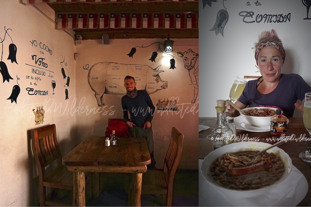
It has been a memorable ending of a stunning day-tour adventure!
...and now let's go to Tilcara
Read more...